You are here: Home > Network List > TA - USArray Transportable Network (new EarthScope stations) Stations List
> Station D23K Nanushuk River, AK USA > Earthquake Result Viewer
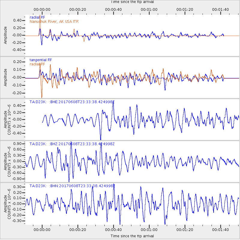
D23K Nanushuk River, AK USA - Earthquake Result Viewer
*The percent match for this event was below the threshold and hence no stack was calculated.
| Earthquake location: |
Mariana Islands Region |
| Earthquake latitude/longitude: |
18.5/147.0 |
| Earthquake time(UTC): |
2017/06/08 (159) 23:23:43 GMT |
| Earthquake Depth: |
8.1 km |
| Earthquake Magnitude: |
5.6 mb |
| Earthquake Catalog/Contributor: |
NEIC PDE/us |
|
| Network: |
TA USArray Transportable Network (new EarthScope stations) |
| Station: |
D23K Nanushuk River, AK USA |
| Lat/Lon: |
68.97 N/150.68 W |
| Elevation: |
406 m |
|
| Distance: |
63.0 deg |
| Az: |
21.012 deg |
| Baz: |
250.471 deg |
| Ray Param: |
$rayparam |
*The percent match for this event was below the threshold and hence was not used in the summary stack. |
|
| Radial Match: |
63.10533 % |
| Radial Bump: |
400 |
| Transverse Match: |
61.26441 % |
| Transverse Bump: |
400 |
| SOD ConfigId: |
13570011 |
| Insert Time: |
2019-04-28 04:09:28.465 +0000 |
| GWidth: |
2.5 |
| Max Bumps: |
400 |
| Tol: |
0.001 |
|
Signal To Noise
| Channel | StoN | STA | LTA |
| TA:D23K: :BHZ:20170608T23:33:38.424998Z | 2.0054543 | 3.123516E-7 | 1.5575104E-7 |
| TA:D23K: :BHN:20170608T23:33:38.424998Z | 1.010238 | 8.6048644E-8 | 8.5176595E-8 |
| TA:D23K: :BHE:20170608T23:33:38.424998Z | 2.6165023 | 2.405177E-7 | 9.192337E-8 |
| Arrivals |
| Ps | |
| PpPs | |
| PsPs/PpSs | |


