You are here: Home > Network List > TA - USArray Transportable Network (new EarthScope stations) Stations List
> Station G21K Allakaket, AK, USA > Earthquake Result Viewer
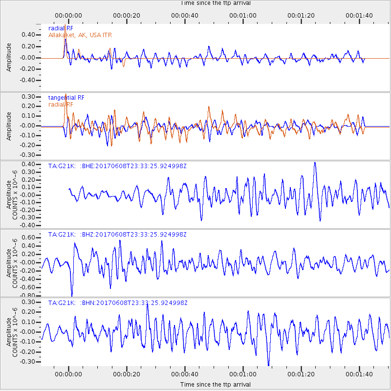
G21K Allakaket, AK, USA - Earthquake Result Viewer
*The percent match for this event was below the threshold and hence no stack was calculated.
| Earthquake location: |
Mariana Islands Region |
| Earthquake latitude/longitude: |
18.5/147.0 |
| Earthquake time(UTC): |
2017/06/08 (159) 23:23:43 GMT |
| Earthquake Depth: |
8.1 km |
| Earthquake Magnitude: |
5.6 mb |
| Earthquake Catalog/Contributor: |
NEIC PDE/us |
|
| Network: |
TA USArray Transportable Network (new EarthScope stations) |
| Station: |
G21K Allakaket, AK, USA |
| Lat/Lon: |
66.52 N/153.51 W |
| Elevation: |
446 m |
|
| Distance: |
61.2 deg |
| Az: |
23.2 deg |
| Baz: |
248.882 deg |
| Ray Param: |
$rayparam |
*The percent match for this event was below the threshold and hence was not used in the summary stack. |
|
| Radial Match: |
73.3946 % |
| Radial Bump: |
400 |
| Transverse Match: |
69.87859 % |
| Transverse Bump: |
400 |
| SOD ConfigId: |
13570011 |
| Insert Time: |
2019-04-28 04:09:41.448 +0000 |
| GWidth: |
2.5 |
| Max Bumps: |
400 |
| Tol: |
0.001 |
|
Signal To Noise
| Channel | StoN | STA | LTA |
| TA:G21K: :BHZ:20170608T23:33:25.924998Z | 4.417429 | 3.1593808E-7 | 7.152081E-8 |
| TA:G21K: :BHN:20170608T23:33:25.924998Z | 1.565215 | 7.302455E-8 | 4.6654648E-8 |
| TA:G21K: :BHE:20170608T23:33:25.924998Z | 2.2452335 | 1.1873434E-7 | 5.2882847E-8 |
| Arrivals |
| Ps | |
| PpPs | |
| PsPs/PpSs | |


