You are here: Home > Network List > TA - USArray Transportable Network (new EarthScope stations) Stations List
> Station K13K Kusilvak Mountain, AK, USA > Earthquake Result Viewer
K13K Kusilvak Mountain, AK, USA - Earthquake Result Viewer

| Earthquake location: |
Mariana Islands Region |
| Earthquake latitude/longitude: |
18.5/147.0 |
| Earthquake time(UTC): |
2017/06/08 (159) 23:23:43 GMT |
| Earthquake Depth: |
8.1 km |
| Earthquake Magnitude: |
5.6 mb |
| Earthquake Catalog/Contributor: |
NEIC PDE/us |
|
| Network: |
TA USArray Transportable Network (new EarthScope stations) |
| Station: |
K13K Kusilvak Mountain, AK, USA |
| Lat/Lon: |
61.93 N/164.66 W |
| Elevation: |
204 m |
|
| Distance: |
54.8 deg |
| Az: |
25.603 deg |
| Baz: |
240.116 deg |
| Ray Param: |
0.06522329 |
| Estimated Moho Depth: |
30.0 km |
| Estimated Crust Vp/Vs: |
1.68 |
| Assumed Crust Vp: |
6.1 km/s |
| Estimated Crust Vs: |
3.626 km/s |
| Estimated Crust Poisson's Ratio: |
0.23 |
|
| Radial Match: |
83.280174 % |
| Radial Bump: |
376 |
| Transverse Match: |
73.66967 % |
| Transverse Bump: |
400 |
| SOD ConfigId: |
13570011 |
| Insert Time: |
2019-04-28 04:09:57.303 +0000 |
| GWidth: |
2.5 |
| Max Bumps: |
400 |
| Tol: |
0.001 |
|
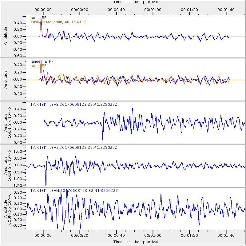
Signal To Noise
| Channel | StoN | STA | LTA |
| TA:K13K: :BHZ:20170608T23:32:41.325022Z | 5.352964 | 4.3704514E-7 | 8.164545E-8 |
| TA:K13K: :BHN:20170608T23:32:41.325022Z | 1.848539 | 1.2304433E-7 | 6.656302E-8 |
| TA:K13K: :BHE:20170608T23:32:41.325022Z | 3.149924 | 1.8379808E-7 | 5.8350004E-8 |
| Arrivals |
| Ps | 3.5 SECOND |
| PpPs | 13 SECOND |
| PsPs/PpSs | 16 SECOND |


