You are here: Home > Network List > TA - USArray Transportable Network (new EarthScope stations) Stations List
> Station L15K Ungalak Mountain, AK, USA > Earthquake Result Viewer
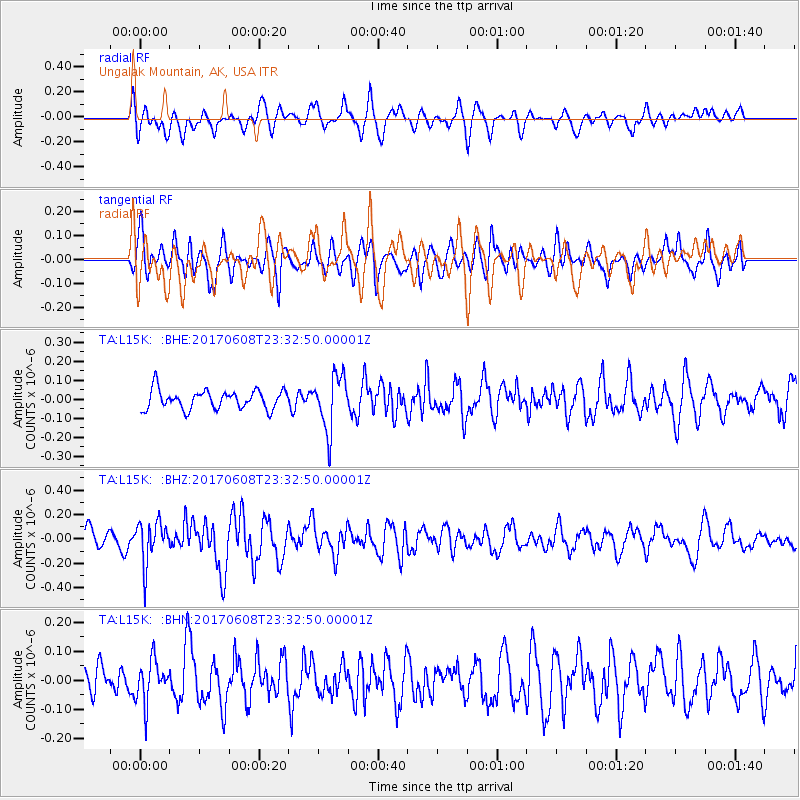
L15K Ungalak Mountain, AK, USA - Earthquake Result Viewer
*The percent match for this event was below the threshold and hence no stack was calculated.
| Earthquake location: |
Mariana Islands Region |
| Earthquake latitude/longitude: |
18.5/147.0 |
| Earthquake time(UTC): |
2017/06/08 (159) 23:23:43 GMT |
| Earthquake Depth: |
8.1 km |
| Earthquake Magnitude: |
5.6 mb |
| Earthquake Catalog/Contributor: |
NEIC PDE/us |
|
| Network: |
TA USArray Transportable Network (new EarthScope stations) |
| Station: |
L15K Ungalak Mountain, AK, USA |
| Lat/Lon: |
61.68 N/161.49 W |
| Elevation: |
219 m |
|
| Distance: |
56.0 deg |
| Az: |
26.74 deg |
| Baz: |
243.551 deg |
| Ray Param: |
$rayparam |
*The percent match for this event was below the threshold and hence was not used in the summary stack. |
|
| Radial Match: |
65.88033 % |
| Radial Bump: |
400 |
| Transverse Match: |
59.675114 % |
| Transverse Bump: |
400 |
| SOD ConfigId: |
13570011 |
| Insert Time: |
2019-04-28 04:10:05.312 +0000 |
| GWidth: |
2.5 |
| Max Bumps: |
400 |
| Tol: |
0.001 |
|
Signal To Noise
| Channel | StoN | STA | LTA |
| TA:L15K: :BHZ:20170608T23:32:50.00001Z | 1.9343132 | 1.7095958E-7 | 8.838258E-8 |
| TA:L15K: :BHN:20170608T23:32:50.00001Z | 1.5325853 | 7.089496E-8 | 4.6258414E-8 |
| TA:L15K: :BHE:20170608T23:32:50.00001Z | 2.9294102 | 1.4482004E-7 | 4.9436583E-8 |
| Arrivals |
| Ps | |
| PpPs | |
| PsPs/PpSs | |


