You are here: Home > Network List > TA - USArray Transportable Network (new EarthScope stations) Stations List
> Station M31M Drury Creek, Yukon, CA > Earthquake Result Viewer
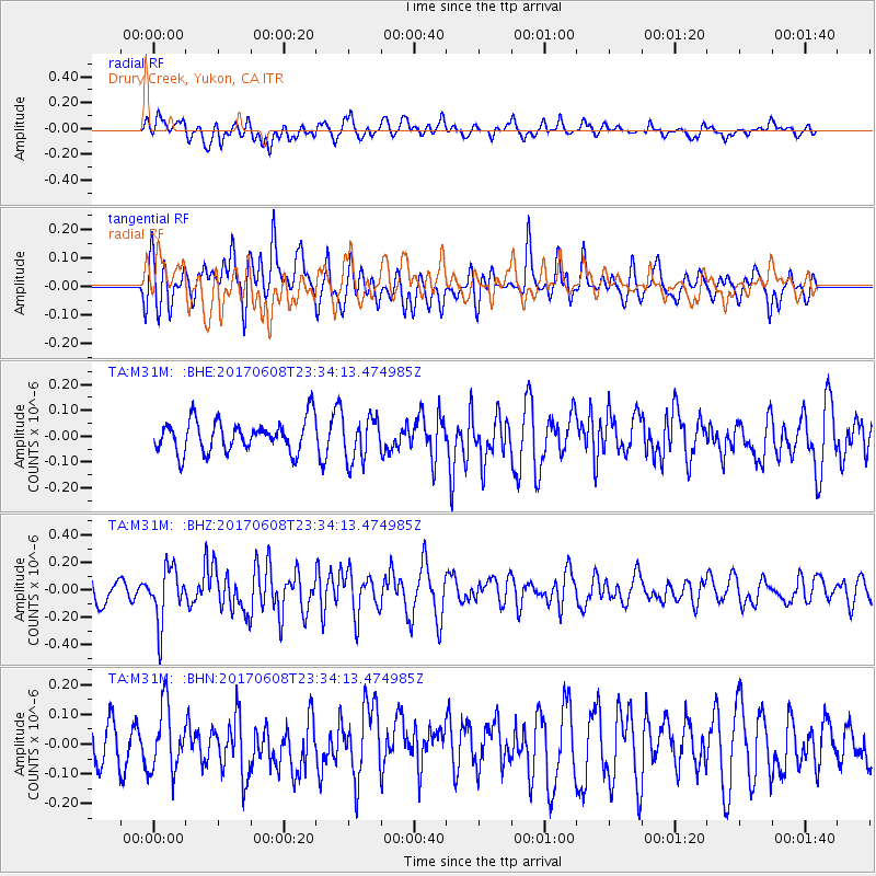
M31M Drury Creek, Yukon, CA - Earthquake Result Viewer
*The percent match for this event was below the threshold and hence no stack was calculated.
| Earthquake location: |
Mariana Islands Region |
| Earthquake latitude/longitude: |
18.5/147.0 |
| Earthquake time(UTC): |
2017/06/08 (159) 23:23:43 GMT |
| Earthquake Depth: |
8.1 km |
| Earthquake Magnitude: |
5.6 mb |
| Earthquake Catalog/Contributor: |
NEIC PDE/us |
|
| Network: |
TA USArray Transportable Network (new EarthScope stations) |
| Station: |
M31M Drury Creek, Yukon, CA |
| Lat/Lon: |
62.20 N/134.39 W |
| Elevation: |
639 m |
|
| Distance: |
68.5 deg |
| Az: |
29.598 deg |
| Baz: |
268.865 deg |
| Ray Param: |
$rayparam |
*The percent match for this event was below the threshold and hence was not used in the summary stack. |
|
| Radial Match: |
49.416336 % |
| Radial Bump: |
400 |
| Transverse Match: |
56.76098 % |
| Transverse Bump: |
400 |
| SOD ConfigId: |
13570011 |
| Insert Time: |
2019-04-28 04:10:20.537 +0000 |
| GWidth: |
2.5 |
| Max Bumps: |
400 |
| Tol: |
0.001 |
|
Signal To Noise
| Channel | StoN | STA | LTA |
| TA:M31M: :BHZ:20170608T23:34:13.474985Z | 1.7858107 | 1.9631013E-7 | 1.0992774E-7 |
| TA:M31M: :BHN:20170608T23:34:13.474985Z | 1.388003 | 1.06909035E-7 | 7.7023635E-8 |
| TA:M31M: :BHE:20170608T23:34:13.474985Z | 1.2078162 | 7.732102E-8 | 6.401721E-8 |
| Arrivals |
| Ps | |
| PpPs | |
| PsPs/PpSs | |


