You are here: Home > Network List > TA - USArray Transportable Network (new EarthScope stations) Stations List
> Station M14A Sheep Mountain BLM, Rosette, UT, USA > Earthquake Result Viewer
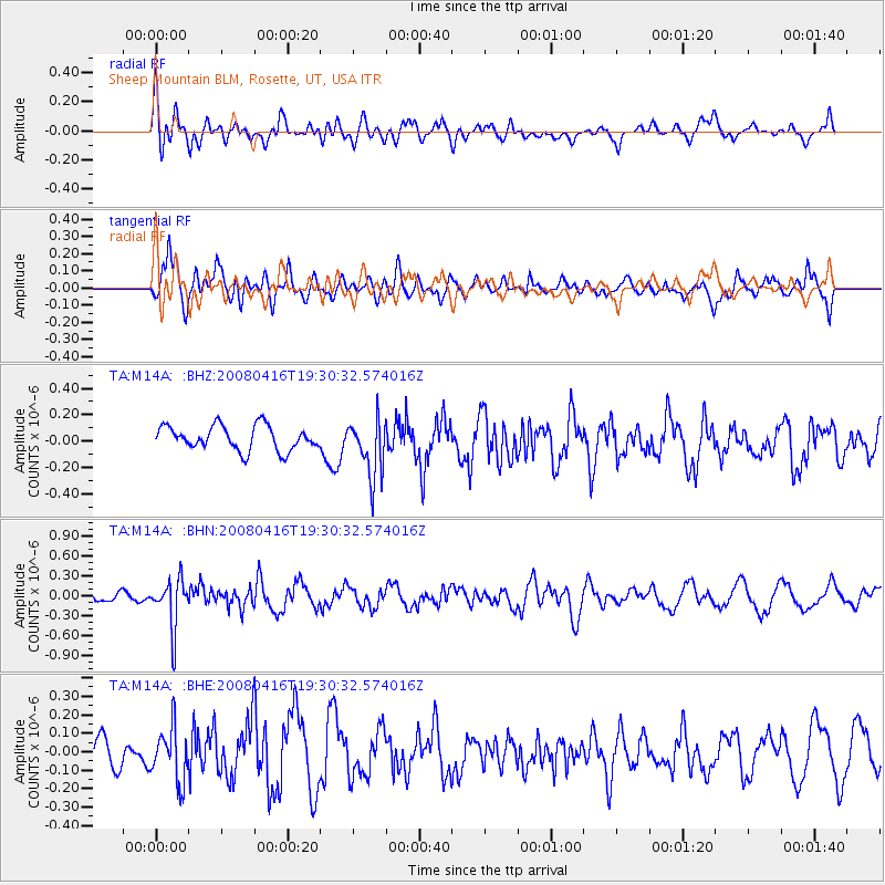
M14A Sheep Mountain BLM, Rosette, UT, USA - Earthquake Result Viewer
*The percent match for this event was below the threshold and hence no stack was calculated.
| Earthquake location: |
Eastern Honshu, Japan |
| Earthquake latitude/longitude: |
39.0/140.0 |
| Earthquake time(UTC): |
2008/04/16 (107) 19:19:36 GMT |
| Earthquake Depth: |
166 km |
| Earthquake Magnitude: |
5.6 MB, 5.8 MW, 5.8 MW |
| Earthquake Catalog/Contributor: |
WHDF/NEIC |
|
| Network: |
TA USArray Transportable Network (new EarthScope stations) |
| Station: |
M14A Sheep Mountain BLM, Rosette, UT, USA |
| Lat/Lon: |
41.50 N/113.35 W |
| Elevation: |
1318 m |
|
| Distance: |
75.7 deg |
| Az: |
47.948 deg |
| Baz: |
309.647 deg |
| Ray Param: |
$rayparam |
*The percent match for this event was below the threshold and hence was not used in the summary stack. |
|
| Radial Match: |
60.004757 % |
| Radial Bump: |
400 |
| Transverse Match: |
66.882515 % |
| Transverse Bump: |
397 |
| SOD ConfigId: |
2504 |
| Insert Time: |
2010-03-06 00:36:04.717 +0000 |
| GWidth: |
2.5 |
| Max Bumps: |
400 |
| Tol: |
0.001 |
|
Signal To Noise
| Channel | StoN | STA | LTA |
| TA:M14A: :BHN:20080416T19:30:32.574016Z | 2.990269 | 3.7049537E-7 | 1.2390035E-7 |
| TA:M14A: :BHE:20080416T19:30:32.574016Z | 1.2391129 | 1.4352291E-7 | 1.1582715E-7 |
| TA:M14A: :BHZ:20080416T19:30:32.574016Z | 2.365119 | 2.1892612E-7 | 9.256453E-8 |
| Arrivals |
| Ps | |
| PpPs | |
| PsPs/PpSs | |


