You are here: Home > Network List > AZ - ANZA Regional Network Stations List
> Station LVA2 AZ.LVA2 > Earthquake Result Viewer
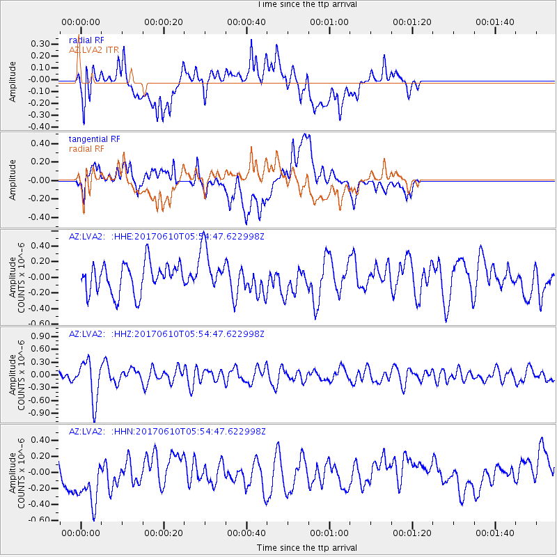
LVA2 AZ.LVA2 - Earthquake Result Viewer
*The percent match for this event was below the threshold and hence no stack was calculated.
| Earthquake location: |
Pacific-Antarctic Ridge |
| Earthquake latitude/longitude: |
-54.4/-146.7 |
| Earthquake time(UTC): |
2017/06/10 (161) 05:42:14 GMT |
| Earthquake Depth: |
10 km |
| Earthquake Magnitude: |
5.6 mb |
| Earthquake Catalog/Contributor: |
NEIC PDE/us |
|
| Network: |
AZ ANZA Regional Network |
| Station: |
LVA2 AZ.LVA2 |
| Lat/Lon: |
33.35 N/116.56 W |
| Elevation: |
1435 m |
|
| Distance: |
91.1 deg |
| Az: |
24.835 deg |
| Baz: |
197.08 deg |
| Ray Param: |
$rayparam |
*The percent match for this event was below the threshold and hence was not used in the summary stack. |
|
| Radial Match: |
56.761166 % |
| Radial Bump: |
400 |
| Transverse Match: |
43.82448 % |
| Transverse Bump: |
400 |
| SOD ConfigId: |
13570011 |
| Insert Time: |
2019-04-28 04:12:17.222 +0000 |
| GWidth: |
2.5 |
| Max Bumps: |
400 |
| Tol: |
0.001 |
|
Signal To Noise
| Channel | StoN | STA | LTA |
| AZ:LVA2: :HHZ:20170610T05:54:47.622998Z | 3.7546544 | 4.81434E-7 | 1.2822325E-7 |
| AZ:LVA2: :HHN:20170610T05:54:47.622998Z | 2.5696044 | 4.134738E-7 | 1.6090952E-7 |
| AZ:LVA2: :HHE:20170610T05:54:47.622998Z | 1.3440194 | 2.5556025E-7 | 1.9014625E-7 |
| Arrivals |
| Ps | |
| PpPs | |
| PsPs/PpSs | |


