You are here: Home > Network List > TA - USArray Transportable Network (new EarthScope stations) Stations List
> Station M14A Sheep Mountain BLM, Rosette, UT, USA > Earthquake Result Viewer
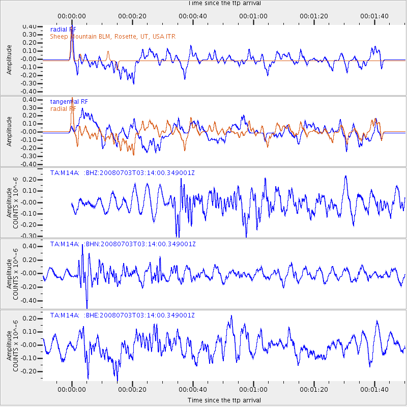
M14A Sheep Mountain BLM, Rosette, UT, USA - Earthquake Result Viewer
*The percent match for this event was below the threshold and hence no stack was calculated.
| Earthquake location: |
South Of Fiji Islands |
| Earthquake latitude/longitude: |
-23.4/-179.8 |
| Earthquake time(UTC): |
2008/07/03 (185) 03:02:37 GMT |
| Earthquake Depth: |
581 km |
| Earthquake Magnitude: |
5.6 MB, 6.2 MW, 6.2 MW |
| Earthquake Catalog/Contributor: |
WHDF/NEIC |
|
| Network: |
TA USArray Transportable Network (new EarthScope stations) |
| Station: |
M14A Sheep Mountain BLM, Rosette, UT, USA |
| Lat/Lon: |
41.50 N/113.35 W |
| Elevation: |
1318 m |
|
| Distance: |
89.1 deg |
| Az: |
43.515 deg |
| Baz: |
237.391 deg |
| Ray Param: |
$rayparam |
*The percent match for this event was below the threshold and hence was not used in the summary stack. |
|
| Radial Match: |
48.09777 % |
| Radial Bump: |
400 |
| Transverse Match: |
45.496876 % |
| Transverse Bump: |
400 |
| SOD ConfigId: |
2504 |
| Insert Time: |
2010-03-06 00:36:26.145 +0000 |
| GWidth: |
2.5 |
| Max Bumps: |
400 |
| Tol: |
0.001 |
|
Signal To Noise
| Channel | StoN | STA | LTA |
| TA:M14A: :BHN:20080703T03:14:00.349001Z | 2.5006473 | 1.396476E-7 | 5.584458E-8 |
| TA:M14A: :BHE:20080703T03:14:00.349001Z | 1.2726526 | 6.821058E-8 | 5.3597176E-8 |
| TA:M14A: :BHZ:20080703T03:14:00.349001Z | 1.6475085 | 1.0128787E-7 | 6.147942E-8 |
| Arrivals |
| Ps | |
| PpPs | |
| PsPs/PpSs | |


