You are here: Home > Network List > AV - Alaska Volcano Observatory Stations List
> Station AMKA Regional Station, Amchitka Island, Alaska > Earthquake Result Viewer
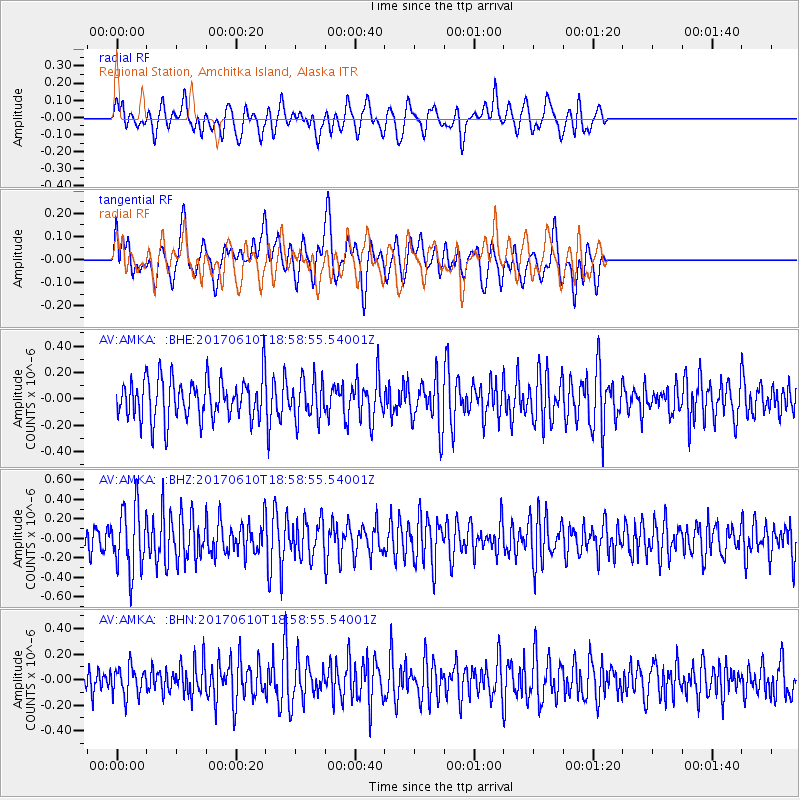
AMKA Regional Station, Amchitka Island, Alaska - Earthquake Result Viewer
*The percent match for this event was below the threshold and hence no stack was calculated.
| Earthquake location: |
Near Coast Of Chiapas, Mexico |
| Earthquake latitude/longitude: |
14.3/-93.0 |
| Earthquake time(UTC): |
2017/06/10 (161) 18:47:31 GMT |
| Earthquake Depth: |
10 km |
| Earthquake Magnitude: |
5.5 Mww |
| Earthquake Catalog/Contributor: |
NEIC PDE/us |
|
| Network: |
AV Alaska Volcano Observatory |
| Station: |
AMKA Regional Station, Amchitka Island, Alaska |
| Lat/Lon: |
51.38 N/179.30 E |
| Elevation: |
116 m |
|
| Distance: |
77.5 deg |
| Az: |
320.106 deg |
| Baz: |
82.735 deg |
| Ray Param: |
$rayparam |
*The percent match for this event was below the threshold and hence was not used in the summary stack. |
|
| Radial Match: |
48.854923 % |
| Radial Bump: |
400 |
| Transverse Match: |
54.277073 % |
| Transverse Bump: |
400 |
| SOD ConfigId: |
13570011 |
| Insert Time: |
2019-04-28 04:16:55.246 +0000 |
| GWidth: |
2.5 |
| Max Bumps: |
400 |
| Tol: |
0.001 |
|
Signal To Noise
| Channel | StoN | STA | LTA |
| AV:AMKA: :BHZ:20170610T18:58:55.54001Z | 2.7276533 | 3.2480835E-7 | 1.1907978E-7 |
| AV:AMKA: :BHN:20170610T18:58:55.54001Z | 0.9205793 | 1.1269791E-7 | 1.2242064E-7 |
| AV:AMKA: :BHE:20170610T18:58:55.54001Z | 0.96971464 | 1.4870848E-7 | 1.5335283E-7 |
| Arrivals |
| Ps | |
| PpPs | |
| PsPs/PpSs | |


