W16A Flagstaff, AZ, USA - Earthquake Result Viewer
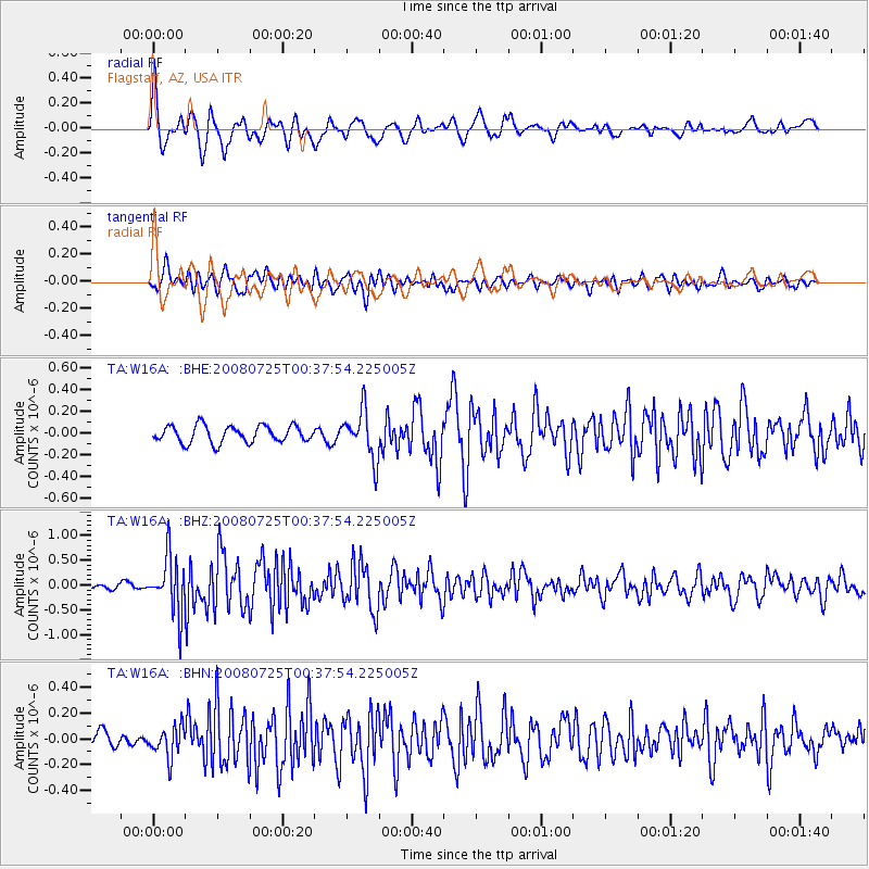
Earthquake location: Rat Islands, Aleutian Islands
Earthquake latitude/longitude: 51.3/179.0
Earthquake time(UTC): 2008/07/25 (207) 00:29:22 GMT
Earthquake Depth: 21 km
Earthquake Magnitude: 5.7 MB, 5.5 MS, 5.9 MW, 5.9 MW
Earthquake Catalog/Contributor: WHDF/NEIC
Network: TA USArray Transportable Network (new EarthScope stations)
Station: W16A Flagstaff, AZ, USA
Lat/Lon: 35.10 N/111.53 W
Elevation: 2192 m
Distance: 51.3 deg
Az: 79.967 deg
Baz: 311.041 deg
Ray Param: 0.06750209
Estimated Moho Depth: 46.0 km
Estimated Crust Vp/Vs: 1.75
Assumed Crust Vp: 6.207 km/s
Estimated Crust Vs: 3.537 km/s
Estimated Crust Poisson's Ratio: 0.26
Radial Match: 84.751915 %
Radial Bump: 400
Transverse Match: 80.60518 %
Transverse Bump: 400
SOD ConfigId: 2504
Insert Time: 2010-03-06 00:37:35.793 +0000
GWidth: 2.5
Max Bumps: 400
Tol: 0.001

Signal To Noise

ChannelStoNSTALTA
TA:W16A: :BHZ:20080725T00:37:54.225005Z9.639665.663316E-75.8750167E-8
TA:W16A: :BHN:20080725T00:37:54.225005Z2.22418021.18076294E-75.3087554E-8
TA:W16A: :BHE:20080725T00:37:54.225005Z2.84564142.20664E-77.7544556E-8
Arrivals
Ps5.9 SECOND
PpPs19 SECOND
PsPs/PpSs25 SECOND