W16A Flagstaff, AZ, USA - Earthquake Result Viewer
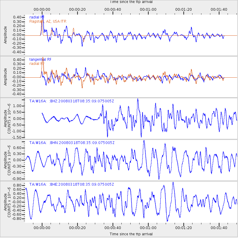
Earthquake location: Kermadec Islands, New Zealand
Earthquake latitude/longitude: -29.3/-177.4
Earthquake time(UTC): 2008/03/18 (078) 08:22:47 GMT
Earthquake Depth: 25 km
Earthquake Magnitude: 5.8 MB, 6.1 MS, 6.2 MW, 6.2 MW
Earthquake Catalog/Contributor: WHDF/NEIC
Network: TA USArray Transportable Network (new EarthScope stations)
Station: W16A Flagstaff, AZ, USA
Lat/Lon: 35.10 N/111.53 W
Elevation: 2192 m
Distance: 89.2 deg
Az: 48.474 deg
Baz: 232.924 deg
Ray Param: 0.042010024
Estimated Moho Depth: 18.0 km
Estimated Crust Vp/Vs: 1.90
Assumed Crust Vp: 6.207 km/s
Estimated Crust Vs: 3.258 km/s
Estimated Crust Poisson's Ratio: 0.31
Radial Match: 82.57755 %
Radial Bump: 400
Transverse Match: 38.8345 %
Transverse Bump: 351
SOD ConfigId: 2564
Insert Time: 2010-03-06 00:37:58.814 +0000
GWidth: 2.5
Max Bumps: 400
Tol: 0.001

Signal To Noise

ChannelStoNSTALTA
TA:W16A: :BHN:20080318T08:35:09.075005Z0.69409711.9665364E-72.8332295E-7
TA:W16A: :BHE:20080318T08:35:09.075005Z0.905187852.8435244E-73.141364E-7
TA:W16A: :BHZ:20080318T08:35:09.075005Z2.09921483.7869987E-71.8040073E-7
Arrivals
Ps2.7 SECOND
PpPs8.3 SECOND
PsPs/PpSs11 SECOND