W16A Flagstaff, AZ, USA - Earthquake Result Viewer
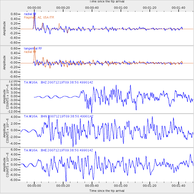
Earthquake location: Andreanof Islands, Aleutian Is.
Earthquake latitude/longitude: 51.4/-179.5
Earthquake time(UTC): 2007/12/19 (353) 09:30:27 GMT
Earthquake Depth: 29 km
Earthquake Magnitude: 6.4 MB, 7.1 MS, 7.1 MW, 7.0 MW
Earthquake Catalog/Contributor: WHDF/NEIC
Network: TA USArray Transportable Network (new EarthScope stations)
Station: W16A Flagstaff, AZ, USA
Lat/Lon: 35.10 N/111.53 W
Elevation: 2192 m
Distance: 50.3 deg
Az: 81.073 deg
Baz: 310.949 deg
Ray Param: 0.06808572
Estimated Moho Depth: 54.25 km
Estimated Crust Vp/Vs: 1.65
Assumed Crust Vp: 6.207 km/s
Estimated Crust Vs: 3.762 km/s
Estimated Crust Poisson's Ratio: 0.21
Radial Match: 91.949615 %
Radial Bump: 391
Transverse Match: 80.47594 %
Transverse Bump: 400
SOD ConfigId: 2564
Insert Time: 2010-03-06 00:38:02.704 +0000
GWidth: 2.5
Max Bumps: 400
Tol: 0.001

Signal To Noise

ChannelStoNSTALTA
TA:W16A: :BHN:20071219T09:38:50.499014Z2.36308721.1430437E-64.837078E-7
TA:W16A: :BHE:20071219T09:38:50.499014Z2.93785241.2450171E-64.2378474E-7
TA:W16A: :BHZ:20071219T09:38:50.499014Z4.966722.7936487E-65.624736E-7
Arrivals
Ps6.0 SECOND
PpPs22 SECOND
PsPs/PpSs28 SECOND