You are here: Home > Network List > TA - USArray Transportable Network (new EarthScope stations) Stations List
> Station I23K Minto, Yukon-Koyukuk, AK, USA > Earthquake Result Viewer
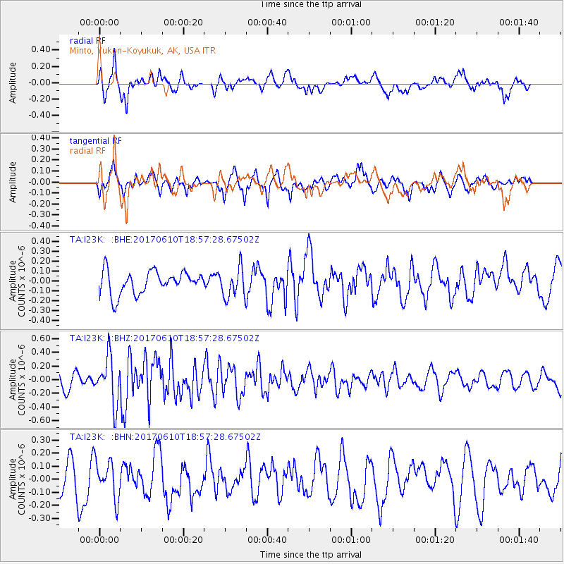
I23K Minto, Yukon-Koyukuk, AK, USA - Earthquake Result Viewer
*The percent match for this event was below the threshold and hence no stack was calculated.
| Earthquake location: |
Near Coast Of Chiapas, Mexico |
| Earthquake latitude/longitude: |
14.3/-93.0 |
| Earthquake time(UTC): |
2017/06/10 (161) 18:47:31 GMT |
| Earthquake Depth: |
10 km |
| Earthquake Magnitude: |
5.5 Mww |
| Earthquake Catalog/Contributor: |
NEIC PDE/us |
|
| Network: |
TA USArray Transportable Network (new EarthScope stations) |
| Station: |
I23K Minto, Yukon-Koyukuk, AK, USA |
| Lat/Lon: |
65.15 N/149.36 W |
| Elevation: |
149 m |
|
| Distance: |
63.3 deg |
| Az: |
336.806 deg |
| Baz: |
115.394 deg |
| Ray Param: |
$rayparam |
*The percent match for this event was below the threshold and hence was not used in the summary stack. |
|
| Radial Match: |
66.85724 % |
| Radial Bump: |
400 |
| Transverse Match: |
54.108543 % |
| Transverse Bump: |
400 |
| SOD ConfigId: |
13570011 |
| Insert Time: |
2019-04-28 04:21:00.487 +0000 |
| GWidth: |
2.5 |
| Max Bumps: |
400 |
| Tol: |
0.001 |
|
Signal To Noise
| Channel | StoN | STA | LTA |
| TA:I23K: :BHZ:20170610T18:57:28.67502Z | 2.0723639 | 3.538248E-7 | 1.7073488E-7 |
| TA:I23K: :BHN:20170610T18:57:28.67502Z | 0.78741735 | 1.3684343E-7 | 1.7378765E-7 |
| TA:I23K: :BHE:20170610T18:57:28.67502Z | 1.3292526 | 1.5279223E-7 | 1.1494597E-7 |
| Arrivals |
| Ps | |
| PpPs | |
| PsPs/PpSs | |


