You are here: Home > Network List > UW - Pacific Northwest Regional Seismic Network Stations List
> Station UMAT Pilot Rock, OR, USA > Earthquake Result Viewer
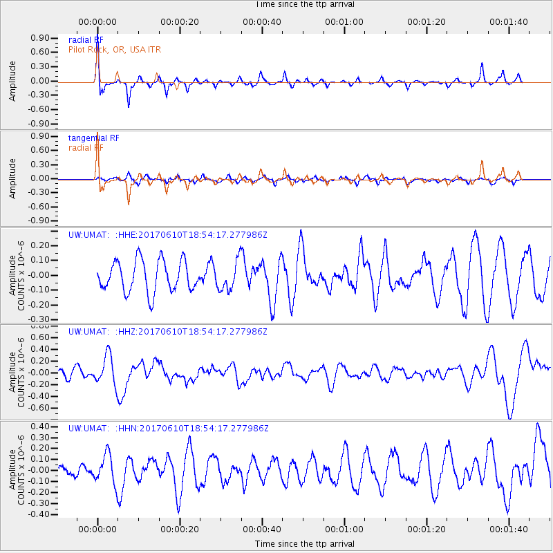
UMAT Pilot Rock, OR, USA - Earthquake Result Viewer
*The percent match for this event was below the threshold and hence no stack was calculated.
| Earthquake location: |
Near Coast Of Chiapas, Mexico |
| Earthquake latitude/longitude: |
14.3/-93.0 |
| Earthquake time(UTC): |
2017/06/10 (161) 18:47:31 GMT |
| Earthquake Depth: |
10 km |
| Earthquake Magnitude: |
5.5 Mww |
| Earthquake Catalog/Contributor: |
NEIC PDE/us |
|
| Network: |
UW Pacific Northwest Regional Seismic Network |
| Station: |
UMAT Pilot Rock, OR, USA |
| Lat/Lon: |
45.29 N/118.96 W |
| Elevation: |
1318 m |
|
| Distance: |
37.9 deg |
| Az: |
329.799 deg |
| Baz: |
136.31 deg |
| Ray Param: |
$rayparam |
*The percent match for this event was below the threshold and hence was not used in the summary stack. |
|
| Radial Match: |
61.807674 % |
| Radial Bump: |
332 |
| Transverse Match: |
56.430584 % |
| Transverse Bump: |
390 |
| SOD ConfigId: |
13570011 |
| Insert Time: |
2019-04-28 04:22:14.706 +0000 |
| GWidth: |
2.5 |
| Max Bumps: |
400 |
| Tol: |
0.001 |
|
Signal To Noise
| Channel | StoN | STA | LTA |
| UW:UMAT: :HHZ:20170610T18:54:17.277986Z | 2.9372568 | 2.6500322E-7 | 9.0221334E-8 |
| UW:UMAT: :HHN:20170610T18:54:17.277986Z | 1.1977488 | 1.4078951E-7 | 1.17545106E-7 |
| UW:UMAT: :HHE:20170610T18:54:17.277986Z | 0.95792 | 1.00327824E-7 | 1.0473508E-7 |
| Arrivals |
| Ps | |
| PpPs | |
| PsPs/PpSs | |


