You are here: Home > Network List > TA - USArray Transportable Network (new EarthScope stations) Stations List
> Station K15K Wolf Creek Mountain, AK, USA > Earthquake Result Viewer
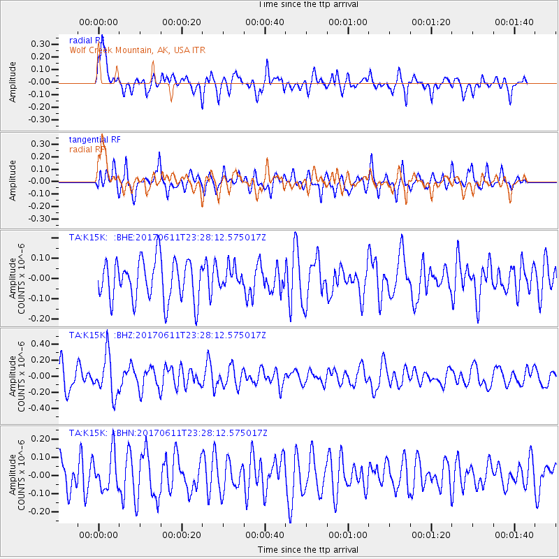
K15K Wolf Creek Mountain, AK, USA - Earthquake Result Viewer
*The percent match for this event was below the threshold and hence no stack was calculated.
| Earthquake location: |
South Of Java, Indonesia |
| Earthquake latitude/longitude: |
-8.3/106.3 |
| Earthquake time(UTC): |
2017/06/11 (162) 23:15:06 GMT |
| Earthquake Depth: |
10 km |
| Earthquake Magnitude: |
5.6 Mww |
| Earthquake Catalog/Contributor: |
NEIC PDE/us |
|
| Network: |
TA USArray Transportable Network (new EarthScope stations) |
| Station: |
K15K Wolf Creek Mountain, AK, USA |
| Lat/Lon: |
62.29 N/161.53 W |
| Elevation: |
346 m |
|
| Distance: |
98.3 deg |
| Az: |
28.164 deg |
| Baz: |
268.059 deg |
| Ray Param: |
$rayparam |
*The percent match for this event was below the threshold and hence was not used in the summary stack. |
|
| Radial Match: |
53.87186 % |
| Radial Bump: |
400 |
| Transverse Match: |
56.862663 % |
| Transverse Bump: |
400 |
| SOD ConfigId: |
13570011 |
| Insert Time: |
2019-04-28 04:24:56.044 +0000 |
| GWidth: |
2.5 |
| Max Bumps: |
400 |
| Tol: |
0.001 |
|
Signal To Noise
| Channel | StoN | STA | LTA |
| TA:K15K: :BHZ:20170611T23:28:12.575017Z | 2.1673687 | 2.6142948E-7 | 1.2062068E-7 |
| TA:K15K: :BHN:20170611T23:28:12.575017Z | 1.1211216 | 1.0097719E-7 | 9.0068006E-8 |
| TA:K15K: :BHE:20170611T23:28:12.575017Z | 0.5101616 | 5.1323862E-8 | 1.0060315E-7 |
| Arrivals |
| Ps | |
| PpPs | |
| PsPs/PpSs | |


