You are here: Home > Network List > TA - USArray Transportable Network (new EarthScope stations) Stations List
> Station 121A Cookes Peak, Deming, NM, USA > Earthquake Result Viewer
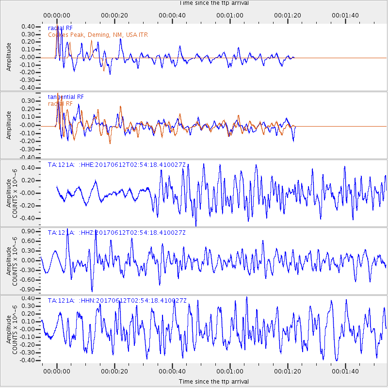
121A Cookes Peak, Deming, NM, USA - Earthquake Result Viewer
*The percent match for this event was below the threshold and hence no stack was calculated.
| Earthquake location: |
Near Coast Of Central Chile |
| Earthquake latitude/longitude: |
-31.5/-71.8 |
| Earthquake time(UTC): |
2017/06/12 (163) 02:43:26 GMT |
| Earthquake Depth: |
26 km |
| Earthquake Magnitude: |
5.6 Mww |
| Earthquake Catalog/Contributor: |
NEIC PDE/us |
|
| Network: |
TA USArray Transportable Network (new EarthScope stations) |
| Station: |
121A Cookes Peak, Deming, NM, USA |
| Lat/Lon: |
32.53 N/107.79 W |
| Elevation: |
1652 m |
|
| Distance: |
72.2 deg |
| Az: |
328.555 deg |
| Baz: |
148.162 deg |
| Ray Param: |
$rayparam |
*The percent match for this event was below the threshold and hence was not used in the summary stack. |
|
| Radial Match: |
74.17312 % |
| Radial Bump: |
400 |
| Transverse Match: |
62.294632 % |
| Transverse Bump: |
379 |
| SOD ConfigId: |
13570011 |
| Insert Time: |
2019-04-28 04:31:49.113 +0000 |
| GWidth: |
2.5 |
| Max Bumps: |
400 |
| Tol: |
0.001 |
|
Signal To Noise
| Channel | StoN | STA | LTA |
| TA:121A: :HHZ:20170612T02:54:18.410027Z | 2.5143924 | 3.5586845E-7 | 1.415326E-7 |
| TA:121A: :HHN:20170612T02:54:18.410027Z | 1.964537 | 1.3360085E-7 | 6.800627E-8 |
| TA:121A: :HHE:20170612T02:54:18.410027Z | 1.3821111 | 1.0322866E-7 | 7.468912E-8 |
| Arrivals |
| Ps | |
| PpPs | |
| PsPs/PpSs | |


