You are here: Home > Network List > UW - Pacific Northwest Regional Seismic Network Stations List
> Station UMAT Pilot Rock, OR, USA > Earthquake Result Viewer
UMAT Pilot Rock, OR, USA - Earthquake Result Viewer
*The percent match for this event was below the threshold and hence no stack was calculated.
| Earthquake location: |
Near Coast Of Central Chile |
| Earthquake latitude/longitude: |
-31.5/-71.8 |
| Earthquake time(UTC): |
2017/06/12 (163) 02:43:26 GMT |
| Earthquake Depth: |
26 km |
| Earthquake Magnitude: |
5.6 Mww |
| Earthquake Catalog/Contributor: |
NEIC PDE/us |
|
| Network: |
UW Pacific Northwest Regional Seismic Network |
| Station: |
UMAT Pilot Rock, OR, USA |
| Lat/Lon: |
45.29 N/118.96 W |
| Elevation: |
1318 m |
|
| Distance: |
87.6 deg |
| Az: |
328.778 deg |
| Baz: |
141.154 deg |
| Ray Param: |
$rayparam |
*The percent match for this event was below the threshold and hence was not used in the summary stack. |
|
| Radial Match: |
53.422802 % |
| Radial Bump: |
400 |
| Transverse Match: |
67.21401 % |
| Transverse Bump: |
338 |
| SOD ConfigId: |
13570011 |
| Insert Time: |
2019-04-28 04:32:46.184 +0000 |
| GWidth: |
2.5 |
| Max Bumps: |
400 |
| Tol: |
0.001 |
|
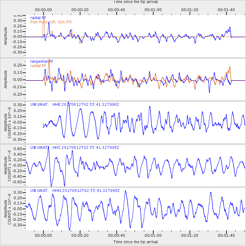
Signal To Noise
| Channel | StoN | STA | LTA |
| UW:UMAT: :HHZ:20170612T02:55:41.327996Z | 3.0092943 | 3.9211213E-7 | 1.3030036E-7 |
| UW:UMAT: :HHN:20170612T02:55:41.327996Z | 1.3912634 | 1.3390374E-7 | 9.6246154E-8 |
| UW:UMAT: :HHE:20170612T02:55:41.327996Z | 1.0692726 | 1.5815793E-7 | 1.4791169E-7 |
| Arrivals |
| Ps | |
| PpPs | |
| PsPs/PpSs | |


