You are here: Home > Network List > CI - Caltech Regional Seismic Network Stations List
> Station MPM Manuel Prospect Mine, California, USA > Earthquake Result Viewer
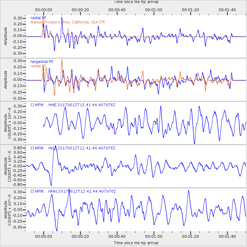
MPM Manuel Prospect Mine, California, USA - Earthquake Result Viewer
*The percent match for this event was below the threshold and hence no stack was calculated.
| Earthquake location: |
Aegean Sea |
| Earthquake latitude/longitude: |
38.9/26.4 |
| Earthquake time(UTC): |
2017/06/12 (163) 12:28:38 GMT |
| Earthquake Depth: |
10 km |
| Earthquake Magnitude: |
6.3 Mww |
| Earthquake Catalog/Contributor: |
NEIC PDE/us |
|
| Network: |
CI Caltech Regional Seismic Network |
| Station: |
MPM Manuel Prospect Mine, California, USA |
| Lat/Lon: |
36.06 N/117.49 W |
| Elevation: |
185 m |
|
| Distance: |
98.3 deg |
| Az: |
331.12 deg |
| Baz: |
27.703 deg |
| Ray Param: |
$rayparam |
*The percent match for this event was below the threshold and hence was not used in the summary stack. |
|
| Radial Match: |
63.384956 % |
| Radial Bump: |
400 |
| Transverse Match: |
63.036854 % |
| Transverse Bump: |
400 |
| SOD ConfigId: |
13570011 |
| Insert Time: |
2019-04-28 04:36:05.907 +0000 |
| GWidth: |
2.5 |
| Max Bumps: |
400 |
| Tol: |
0.001 |
|
Signal To Noise
| Channel | StoN | STA | LTA |
| CI:MPM: :HHZ:20170612T12:41:44.407976Z | 2.87976 | 3.5619016E-7 | 1.2368746E-7 |
| CI:MPM: :HHN:20170612T12:41:44.407976Z | 1.6729134 | 1.36335E-7 | 8.149555E-8 |
| CI:MPM: :HHE:20170612T12:41:44.407976Z | 0.52004856 | 6.9142544E-8 | 1.3295401E-7 |
| Arrivals |
| Ps | |
| PpPs | |
| PsPs/PpSs | |


