You are here: Home > Network List > GM - US Geological Survey Networks Stations List
> Station IWM01 Jericho 2M Well Monitoring Station > Earthquake Result Viewer
IWM01 Jericho 2M Well Monitoring Station - Earthquake Result Viewer
*The percent match for this event was below the threshold and hence no stack was calculated.
| Earthquake location: |
Aegean Sea |
| Earthquake latitude/longitude: |
38.9/26.4 |
| Earthquake time(UTC): |
2017/06/12 (163) 12:28:38 GMT |
| Earthquake Depth: |
10 km |
| Earthquake Magnitude: |
6.3 Mww |
| Earthquake Catalog/Contributor: |
NEIC PDE/us |
|
| Network: |
GM US Geological Survey Networks |
| Station: |
IWM01 Jericho 2M Well Monitoring Station |
| Lat/Lon: |
36.73 N/96.53 W |
| Elevation: |
328 m |
|
| Distance: |
88.1 deg |
| Az: |
317.55 deg |
| Baz: |
40.938 deg |
| Ray Param: |
$rayparam |
*The percent match for this event was below the threshold and hence was not used in the summary stack. |
|
| Radial Match: |
53.45931 % |
| Radial Bump: |
400 |
| Transverse Match: |
33.035793 % |
| Transverse Bump: |
400 |
| SOD ConfigId: |
13570011 |
| Insert Time: |
2019-04-28 04:37:48.047 +0000 |
| GWidth: |
2.5 |
| Max Bumps: |
400 |
| Tol: |
0.001 |
|
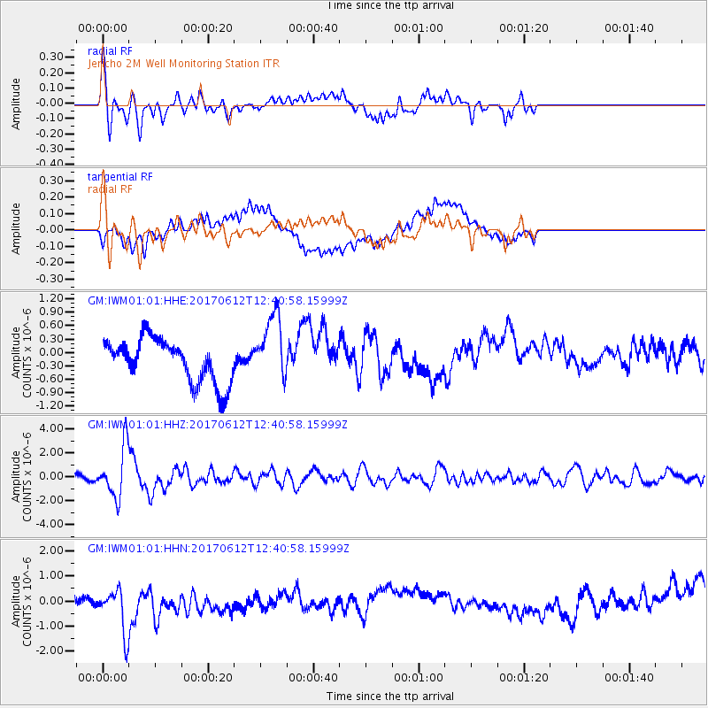
Signal To Noise
| Channel | StoN | STA | LTA |
| GM:IWM01:01:HHZ:20170612T12:40:58.15999Z | 7.9377832 | 2.1601836E-6 | 2.721394E-7 |
| GM:IWM01:01:HHN:20170612T12:40:58.15999Z | 3.6689117 | 1.0410384E-6 | 2.8374586E-7 |
| GM:IWM01:01:HHE:20170612T12:40:58.15999Z | 1.5746548 | 7.5601235E-7 | 4.8011304E-7 |
| Arrivals |
| Ps | |
| PpPs | |
| PsPs/PpSs | |


