You are here: Home > Network List > TA - USArray Transportable Network (new EarthScope stations) Stations List
> Station 113A Mohawk Valley, Roll, AZ, USA > Earthquake Result Viewer
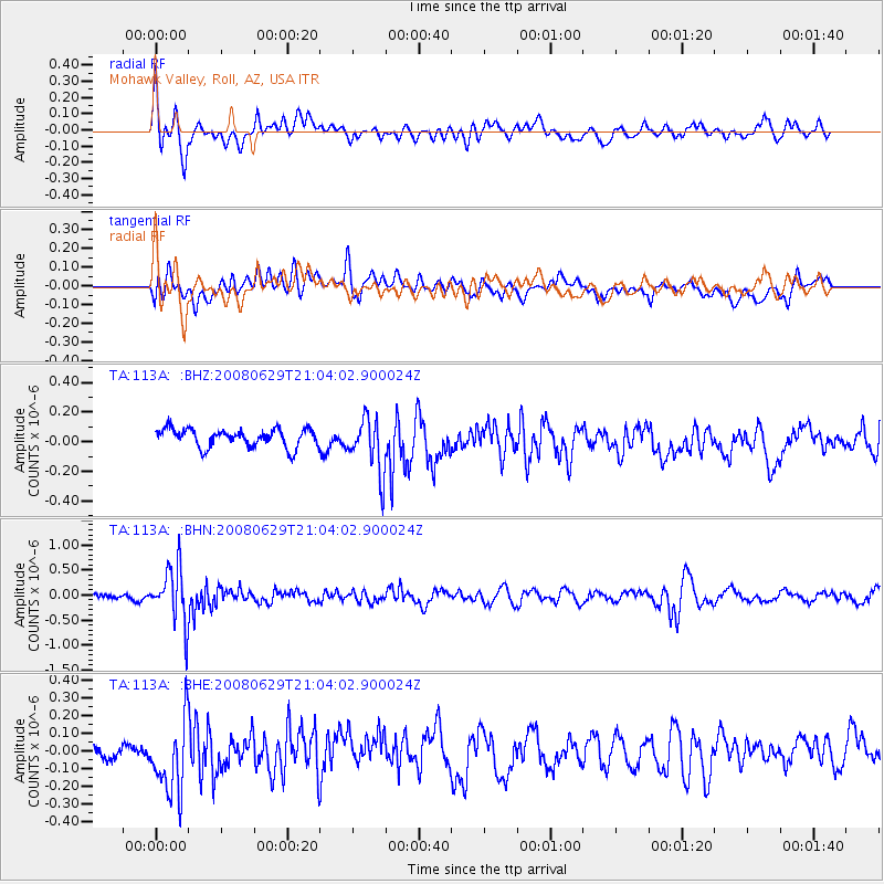
113A Mohawk Valley, Roll, AZ, USA - Earthquake Result Viewer
*The percent match for this event was below the threshold and hence no stack was calculated.
| Earthquake location: |
Primor'ye, Russia |
| Earthquake latitude/longitude: |
45.2/137.4 |
| Earthquake time(UTC): |
2008/06/29 (181) 20:53:01 GMT |
| Earthquake Depth: |
287 km |
| Earthquake Magnitude: |
5.6 MB, 6.0 MW, 5.9 MW |
| Earthquake Catalog/Contributor: |
WHDF/NEIC |
|
| Network: |
TA USArray Transportable Network (new EarthScope stations) |
| Station: |
113A Mohawk Valley, Roll, AZ, USA |
| Lat/Lon: |
32.77 N/113.77 W |
| Elevation: |
118 m |
|
| Distance: |
79.1 deg |
| Az: |
54.298 deg |
| Baz: |
317.006 deg |
| Ray Param: |
$rayparam |
*The percent match for this event was below the threshold and hence was not used in the summary stack. |
|
| Radial Match: |
68.959076 % |
| Radial Bump: |
400 |
| Transverse Match: |
38.68815 % |
| Transverse Bump: |
400 |
| SOD ConfigId: |
2504 |
| Insert Time: |
2010-03-06 00:44:40.166 +0000 |
| GWidth: |
2.5 |
| Max Bumps: |
400 |
| Tol: |
0.001 |
|
Signal To Noise
| Channel | StoN | STA | LTA |
| TA:113A: :BHN:20080629T21:04:02.900024Z | 9.896967 | 5.5926625E-7 | 5.6508856E-8 |
| TA:113A: :BHE:20080629T21:04:02.900024Z | 3.626185 | 2.3936295E-7 | 6.600958E-8 |
| TA:113A: :BHZ:20080629T21:04:02.900024Z | 3.052933 | 1.857821E-7 | 6.0853644E-8 |
| Arrivals |
| Ps | |
| PpPs | |
| PsPs/PpSs | |


