You are here: Home > Network List > TA - USArray Transportable Network (new EarthScope stations) Stations List
> Station 113A Mohawk Valley, Roll, AZ, USA > Earthquake Result Viewer
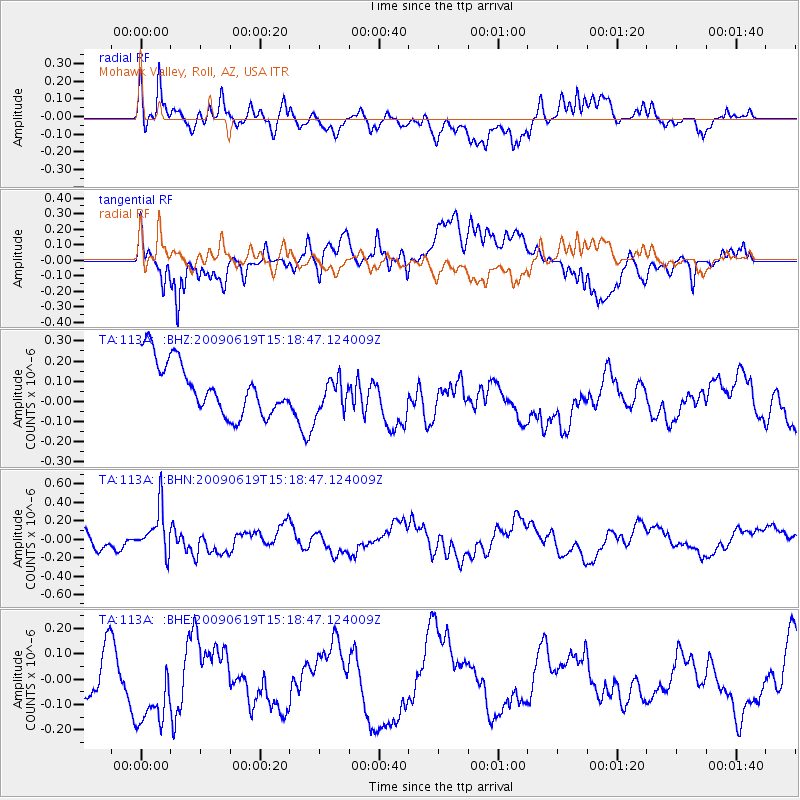
113A Mohawk Valley, Roll, AZ, USA - Earthquake Result Viewer
*The percent match for this event was below the threshold and hence no stack was calculated.
| Earthquake location: |
Mariana Islands |
| Earthquake latitude/longitude: |
14.1/145.2 |
| Earthquake time(UTC): |
2009/06/19 (170) 15:06:24 GMT |
| Earthquake Depth: |
114 km |
| Earthquake Magnitude: |
5.5 MB, 5.5 MW |
| Earthquake Catalog/Contributor: |
WHDF/NEIC |
|
| Network: |
TA USArray Transportable Network (new EarthScope stations) |
| Station: |
113A Mohawk Valley, Roll, AZ, USA |
| Lat/Lon: |
32.77 N/113.77 W |
| Elevation: |
118 m |
|
| Distance: |
91.5 deg |
| Az: |
55.812 deg |
| Baz: |
287.689 deg |
| Ray Param: |
$rayparam |
*The percent match for this event was below the threshold and hence was not used in the summary stack. |
|
| Radial Match: |
59.64911 % |
| Radial Bump: |
400 |
| Transverse Match: |
79.850555 % |
| Transverse Bump: |
400 |
| SOD ConfigId: |
2648 |
| Insert Time: |
2010-03-06 00:45:58.206 +0000 |
| GWidth: |
2.5 |
| Max Bumps: |
400 |
| Tol: |
0.001 |
|
Signal To Noise
| Channel | StoN | STA | LTA |
| TA:113A: :BHN:20090619T15:18:47.124009Z | 3.9551687 | 2.4766888E-7 | 6.2619044E-8 |
| TA:113A: :BHE:20090619T15:18:47.124009Z | 1.6390138 | 1.9084634E-7 | 1.1643974E-7 |
| TA:113A: :BHZ:20090619T15:18:47.124009Z | 0.64486164 | 8.360155E-8 | 1.2964261E-7 |
| Arrivals |
| Ps | |
| PpPs | |
| PsPs/PpSs | |


