You are here: Home > Network List > TA - USArray Transportable Network (new EarthScope stations) Stations List
> Station 113A Mohawk Valley, Roll, AZ, USA > Earthquake Result Viewer
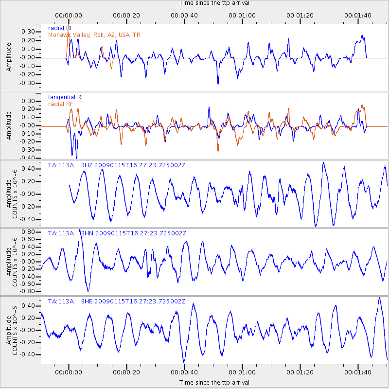
113A Mohawk Valley, Roll, AZ, USA - Earthquake Result Viewer
*The percent match for this event was below the threshold and hence no stack was calculated.
| Earthquake location: |
Solomon Islands |
| Earthquake latitude/longitude: |
-10.3/161.2 |
| Earthquake time(UTC): |
2009/01/15 (015) 16:15:01 GMT |
| Earthquake Depth: |
114 km |
| Earthquake Magnitude: |
5.6 MB, 5.7 MW, 5.7 MW |
| Earthquake Catalog/Contributor: |
WHDF/NEIC |
|
| Network: |
TA USArray Transportable Network (new EarthScope stations) |
| Station: |
113A Mohawk Valley, Roll, AZ, USA |
| Lat/Lon: |
32.77 N/113.77 W |
| Elevation: |
118 m |
|
| Distance: |
91.4 deg |
| Az: |
57.096 deg |
| Baz: |
258.685 deg |
| Ray Param: |
$rayparam |
*The percent match for this event was below the threshold and hence was not used in the summary stack. |
|
| Radial Match: |
53.310436 % |
| Radial Bump: |
400 |
| Transverse Match: |
66.140495 % |
| Transverse Bump: |
352 |
| SOD ConfigId: |
2658 |
| Insert Time: |
2010-03-06 00:46:19.506 +0000 |
| GWidth: |
2.5 |
| Max Bumps: |
400 |
| Tol: |
0.001 |
|
Signal To Noise
| Channel | StoN | STA | LTA |
| TA:113A: :BHN:20090115T16:27:23.725002Z | 2.7682385 | 4.4719903E-7 | 1.6154642E-7 |
| TA:113A: :BHE:20090115T16:27:23.725002Z | 0.7274624 | 1.5242198E-7 | 2.0952557E-7 |
| TA:113A: :BHZ:20090115T16:27:23.725002Z | 0.6901079 | 1.5962745E-7 | 2.3130796E-7 |
| Arrivals |
| Ps | |
| PpPs | |
| PsPs/PpSs | |


