You are here: Home > Network List > IW - Intermountain West Stations List
> Station MOOW Moose Ponds, Wyoming, USA > Earthquake Result Viewer
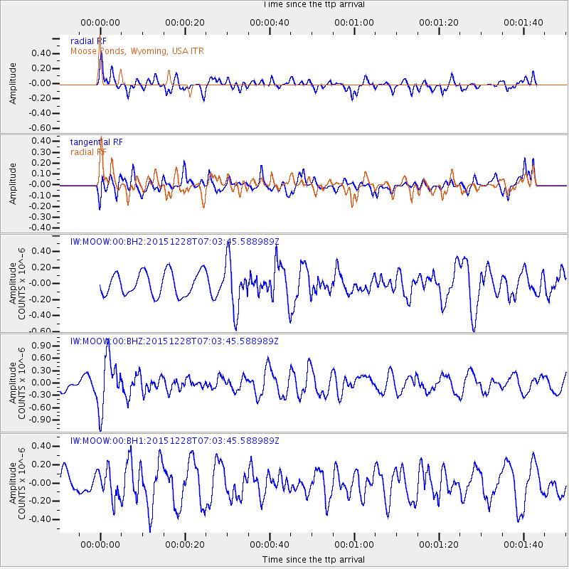
MOOW Moose Ponds, Wyoming, USA - Earthquake Result Viewer
*The percent match for this event was below the threshold and hence no stack was calculated.
| Earthquake location: |
Windward Islands |
| Earthquake latitude/longitude: |
14.6/-61.4 |
| Earthquake time(UTC): |
2015/12/28 (362) 06:55:30 GMT |
| Earthquake Depth: |
153 km |
| Earthquake Magnitude: |
5.6 MWP |
| Earthquake Catalog/Contributor: |
NEIC PDE/NEIC COMCAT |
|
| Network: |
IW Intermountain West |
| Station: |
MOOW Moose Ponds, Wyoming, USA |
| Lat/Lon: |
43.75 N/110.74 W |
| Elevation: |
2128 m |
|
| Distance: |
51.0 deg |
| Az: |
314.945 deg |
| Baz: |
108.995 deg |
| Ray Param: |
$rayparam |
*The percent match for this event was below the threshold and hence was not used in the summary stack. |
|
| Radial Match: |
63.263405 % |
| Radial Bump: |
400 |
| Transverse Match: |
57.44247 % |
| Transverse Bump: |
400 |
| SOD ConfigId: |
1259291 |
| Insert Time: |
2016-01-11 07:32:24.326 +0000 |
| GWidth: |
2.5 |
| Max Bumps: |
400 |
| Tol: |
0.001 |
|
Signal To Noise
| Channel | StoN | STA | LTA |
| IW:MOOW:00:BHZ:20151228T07:03:45.588989Z | 3.458003 | 6.441135E-7 | 1.8626748E-7 |
| IW:MOOW:00:BH1:20151228T07:03:45.588989Z | 0.840197 | 1.6293188E-7 | 1.9392104E-7 |
| IW:MOOW:00:BH2:20151228T07:03:45.588989Z | 2.1336339 | 3.0827482E-7 | 1.4448348E-7 |
| Arrivals |
| Ps | |
| PpPs | |
| PsPs/PpSs | |


