You are here: Home > Network List > TA - USArray Transportable Network (new EarthScope stations) Stations List
> Station MSTX Muleshoe, TX, USA > Earthquake Result Viewer
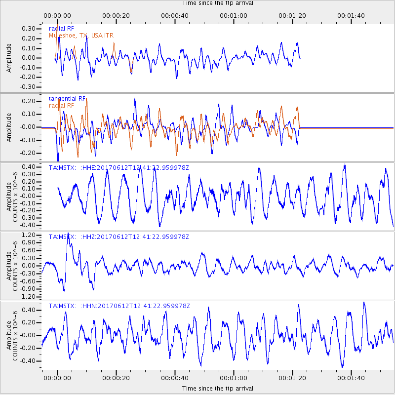
MSTX Muleshoe, TX, USA - Earthquake Result Viewer
*The percent match for this event was below the threshold and hence no stack was calculated.
| Earthquake location: |
Aegean Sea |
| Earthquake latitude/longitude: |
38.9/26.4 |
| Earthquake time(UTC): |
2017/06/12 (163) 12:28:38 GMT |
| Earthquake Depth: |
10 km |
| Earthquake Magnitude: |
6.3 Mww |
| Earthquake Catalog/Contributor: |
NEIC PDE/us |
|
| Network: |
TA USArray Transportable Network (new EarthScope stations) |
| Station: |
MSTX Muleshoe, TX, USA |
| Lat/Lon: |
33.97 N/102.77 W |
| Elevation: |
1167 m |
|
| Distance: |
93.5 deg |
| Az: |
319.773 deg |
| Baz: |
37.308 deg |
| Ray Param: |
$rayparam |
*The percent match for this event was below the threshold and hence was not used in the summary stack. |
|
| Radial Match: |
46.595318 % |
| Radial Bump: |
400 |
| Transverse Match: |
42.79514 % |
| Transverse Bump: |
400 |
| SOD ConfigId: |
13570011 |
| Insert Time: |
2019-04-28 04:44:22.206 +0000 |
| GWidth: |
2.5 |
| Max Bumps: |
400 |
| Tol: |
0.001 |
|
Signal To Noise
| Channel | StoN | STA | LTA |
| TA:MSTX: :HHZ:20170612T12:41:22.959978Z | 3.999544 | 6.9912306E-7 | 1.748007E-7 |
| TA:MSTX: :HHN:20170612T12:41:22.959978Z | 1.3390663 | 2.1460612E-7 | 1.602655E-7 |
| TA:MSTX: :HHE:20170612T12:41:22.959978Z | 1.1905161 | 2.2250354E-7 | 1.868967E-7 |
| Arrivals |
| Ps | |
| PpPs | |
| PsPs/PpSs | |


