You are here: Home > Network List > UW - Pacific Northwest Regional Seismic Network Stations List
> Station MRBL Marblemount, WA, USA > Earthquake Result Viewer
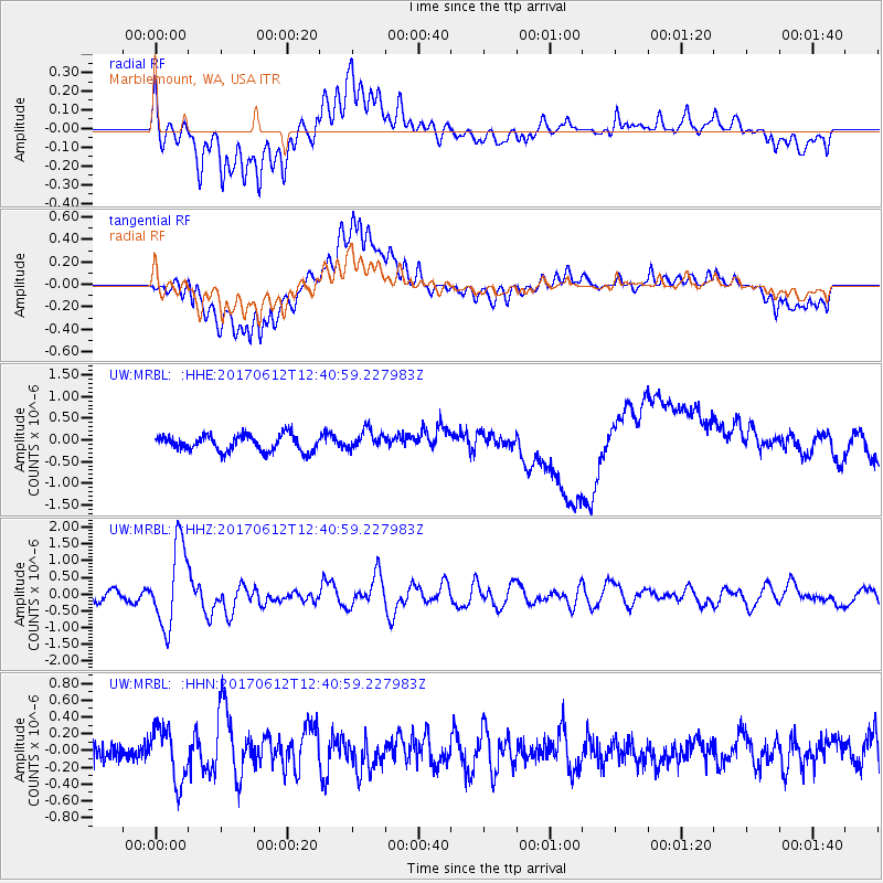
MRBL Marblemount, WA, USA - Earthquake Result Viewer
*The percent match for this event was below the threshold and hence no stack was calculated.
| Earthquake location: |
Aegean Sea |
| Earthquake latitude/longitude: |
38.9/26.4 |
| Earthquake time(UTC): |
2017/06/12 (163) 12:28:38 GMT |
| Earthquake Depth: |
10 km |
| Earthquake Magnitude: |
6.3 Mww |
| Earthquake Catalog/Contributor: |
NEIC PDE/us |
|
| Network: |
UW Pacific Northwest Regional Seismic Network |
| Station: |
MRBL Marblemount, WA, USA |
| Lat/Lon: |
48.52 N/121.48 W |
| Elevation: |
75 m |
|
| Distance: |
88.4 deg |
| Az: |
339.27 deg |
| Baz: |
24.534 deg |
| Ray Param: |
$rayparam |
*The percent match for this event was below the threshold and hence was not used in the summary stack. |
|
| Radial Match: |
58.64847 % |
| Radial Bump: |
400 |
| Transverse Match: |
49.524406 % |
| Transverse Bump: |
400 |
| SOD ConfigId: |
13570011 |
| Insert Time: |
2019-04-28 04:46:13.382 +0000 |
| GWidth: |
2.5 |
| Max Bumps: |
400 |
| Tol: |
0.001 |
|
Signal To Noise
| Channel | StoN | STA | LTA |
| UW:MRBL: :HHZ:20170612T12:40:59.227983Z | 9.57585 | 1.2188891E-6 | 1.2728783E-7 |
| UW:MRBL: :HHN:20170612T12:40:59.227983Z | 2.7797487 | 3.268725E-7 | 1.1759067E-7 |
| UW:MRBL: :HHE:20170612T12:40:59.227983Z | 1.2499056 | 2.3044166E-7 | 1.8436725E-7 |
| Arrivals |
| Ps | |
| PpPs | |
| PsPs/PpSs | |


