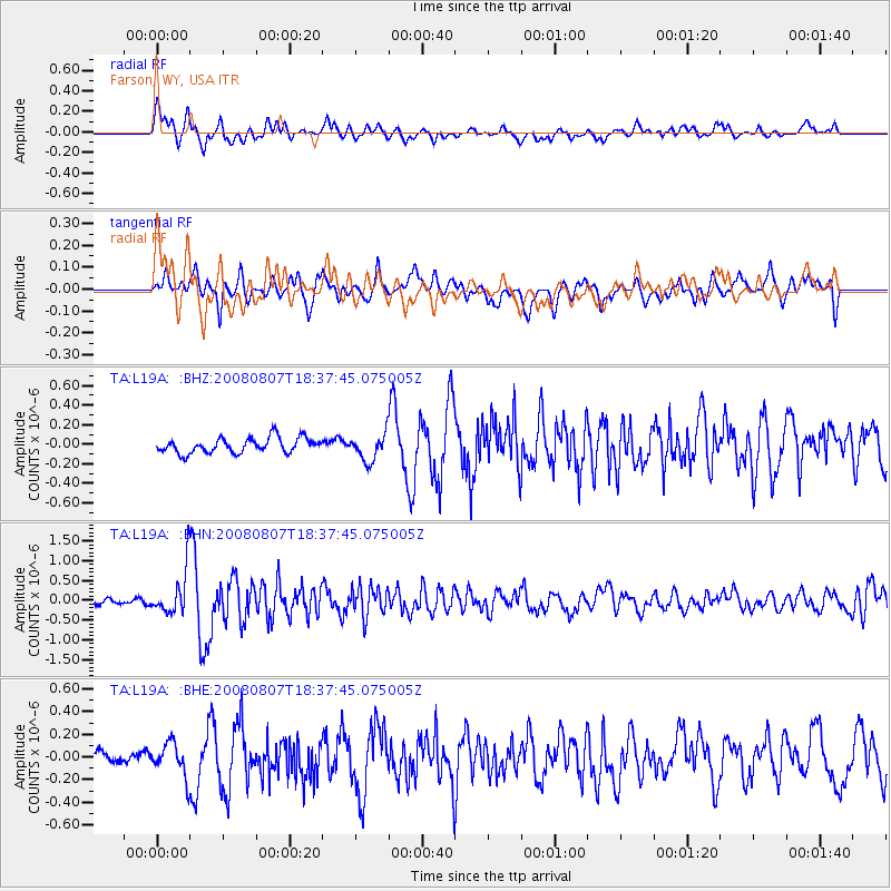
L19A Farson, WY, USA - Earthquake Result Viewer
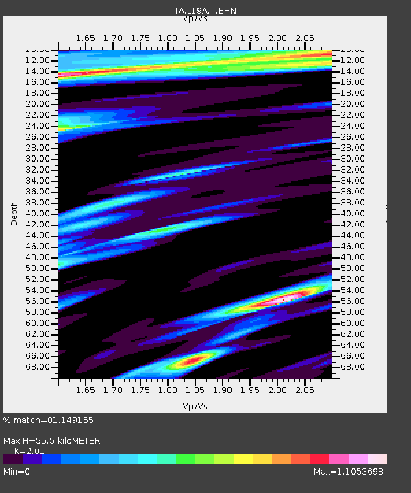
Earthquake location: Andreanof Islands, Aleutian Is.
Earthquake latitude/longitude: 52.2/-175.7
Earthquake time(UTC): 2008/08/07 (220) 18:30:03 GMT
Earthquake Depth: 12 km
Earthquake Magnitude: 5.6 MB, 5.5 MS, 5.8 MW, 5.8 MW
Earthquake Catalog/Contributor: WHDF/NEIC
Network: TA USArray Transportable Network (new EarthScope stations)
Station: L19A Farson, WY, USA
Lat/Lon: 42.10 N/109.36 W
Elevation: 2034 m
Distance: 44.7 deg
Az: 75.563 deg
Baz: 306.765 deg
Ray Param: 0.07173919
Estimated Moho Depth: 55.5 km
Estimated Crust Vp/Vs: 2.01
Assumed Crust Vp: 6.161 km/s
Estimated Crust Vs: 3.065 km/s
Estimated Crust Poisson's Ratio: 0.34
Radial Match: 81.149155 %
Radial Bump: 400
Transverse Match: 76.85336 %
Transverse Bump: 400
SOD ConfigId: 2504
Insert Time: 2010-03-06 00:47:32.816 +0000
GWidth: 2.5
Max Bumps: 400
Tol: 0.001

Signal To Noise

ChannelStoNSTALTA
TA:L19A: :BHN:20080807T18:37:45.075005Z6.3559985.5844447E-78.7861025E-8
TA:L19A: :BHE:20080807T18:37:45.075005Z2.05383521.4880814E-77.245379E-8
TA:L19A: :BHZ:20080807T18:37:45.075005Z1.76983131.358849E-77.677845E-8
Arrivals
Ps9.6 SECOND
PpPs26 SECOND
PsPs/PpSs35 SECOND