
L19A Farson, WY, USA - Earthquake Result Viewer
| ||||||||||||||||||
| ||||||||||||||||||
| ||||||||||||||||||
|
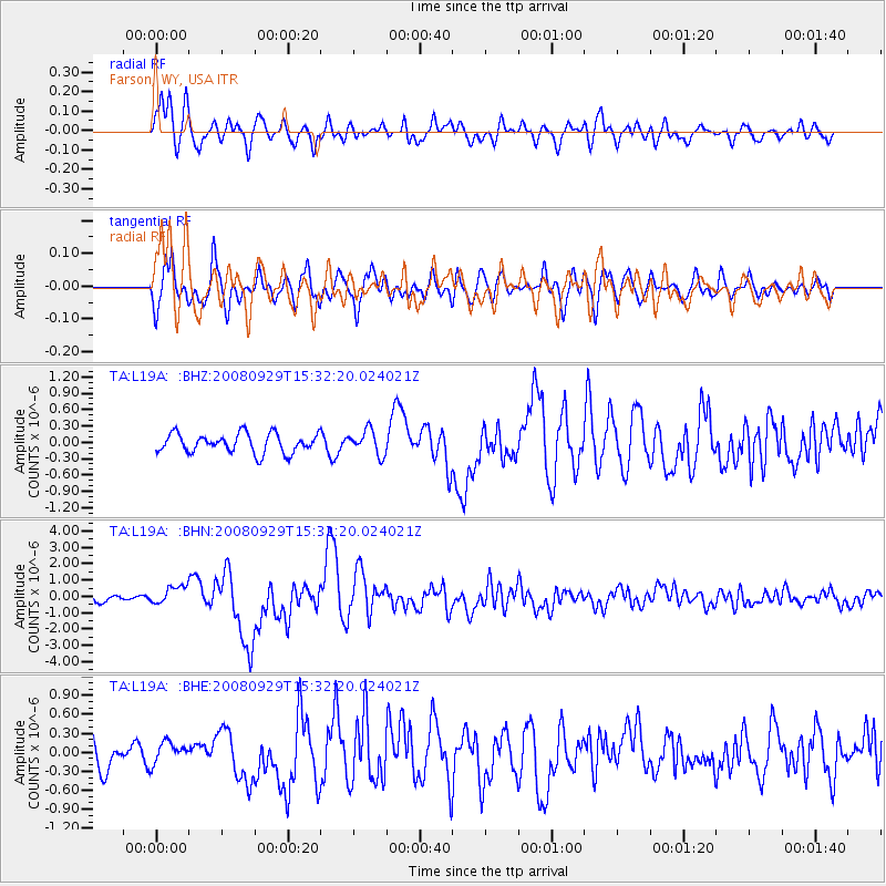
Signal To Noise
| Channel | StoN | STA | LTA |
| TA:L19A: :BHN:20080929T15:32:20.024021Z | 2.8152044 | 5.578264E-7 | 1.9814773E-7 |
| TA:L19A: :BHE:20080929T15:32:20.024021Z | 0.7306734 | 1.6776178E-7 | 2.2959887E-7 |
| TA:L19A: :BHZ:20080929T15:32:20.024021Z | 1.2827525 | 2.2415261E-7 | 1.7474346E-7 |
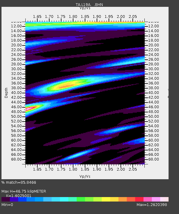
| Arrivals | |
| Ps | 4.7 SECOND |
| PpPs | 19 SECOND |
| PsPs/PpSs | 24 SECOND |

