You are here: Home > Network List > TA - USArray Transportable Network (new EarthScope stations) Stations List
> Station L19A Farson, WY, USA > Earthquake Result Viewer
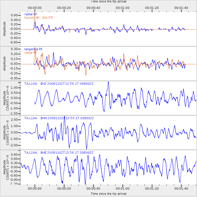
L19A Farson, WY, USA - Earthquake Result Viewer
*The percent match for this event was below the threshold and hence no stack was calculated.
| Earthquake location: |
Andreanof Islands, Aleutian Is. |
| Earthquake latitude/longitude: |
51.6/-174.4 |
| Earthquake time(UTC): |
2008/11/02 (307) 13:48:42 GMT |
| Earthquake Depth: |
36 km |
| Earthquake Magnitude: |
5.7 MB, 5.8 MS, 6.1 MW, 6.1 MW |
| Earthquake Catalog/Contributor: |
WHDF/NEIC |
|
| Network: |
TA USArray Transportable Network (new EarthScope stations) |
| Station: |
L19A Farson, WY, USA |
| Lat/Lon: |
42.10 N/109.36 W |
| Elevation: |
2034 m |
|
| Distance: |
44.1 deg |
| Az: |
75.738 deg |
| Baz: |
305.598 deg |
| Ray Param: |
$rayparam |
*The percent match for this event was below the threshold and hence was not used in the summary stack. |
|
| Radial Match: |
52.87904 % |
| Radial Bump: |
356 |
| Transverse Match: |
50.887093 % |
| Transverse Bump: |
336 |
| SOD ConfigId: |
2658 |
| Insert Time: |
2010-03-06 00:48:37.061 +0000 |
| GWidth: |
2.5 |
| Max Bumps: |
400 |
| Tol: |
0.001 |
|
Signal To Noise
| Channel | StoN | STA | LTA |
| TA:L19A: :BHN:20081102T13:56:17.098992Z | 3.856321 | 6.8159295E-7 | 1.7674694E-7 |
| TA:L19A: :BHE:20081102T13:56:17.098992Z | 1.8997104 | 4.948279E-7 | 2.6047542E-7 |
| TA:L19A: :BHZ:20081102T13:56:17.098992Z | 0.89739615 | 3.99127E-7 | 4.447612E-7 |
| Arrivals |
| Ps | |
| PpPs | |
| PsPs/PpSs | |


