You are here: Home > Network List > AK - Alaska Regional Network Stations List
> Station MDM Murphy Dome > Earthquake Result Viewer
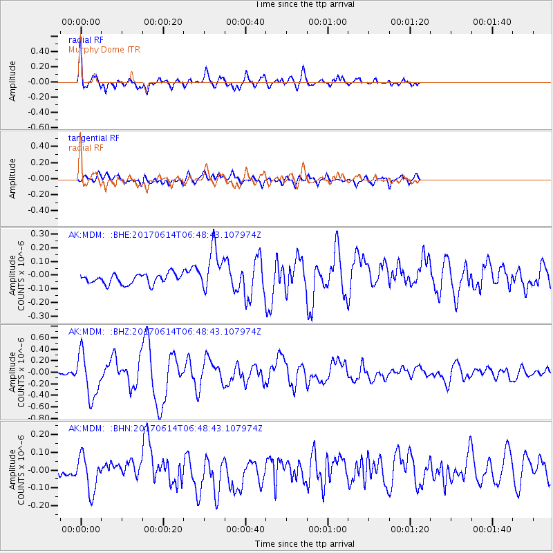
MDM Murphy Dome - Earthquake Result Viewer
*The percent match for this event was below the threshold and hence no stack was calculated.
| Earthquake location: |
Near Coast Of Chiapas, Mexico |
| Earthquake latitude/longitude: |
14.2/-93.2 |
| Earthquake time(UTC): |
2017/06/14 (165) 06:38:48 GMT |
| Earthquake Depth: |
11 km |
| Earthquake Magnitude: |
5.5 Mww |
| Earthquake Catalog/Contributor: |
NEIC PDE/us |
|
| Network: |
AK Alaska Regional Network |
| Station: |
MDM Murphy Dome |
| Lat/Lon: |
64.96 N/148.23 W |
| Elevation: |
634 m |
|
| Distance: |
62.8 deg |
| Az: |
336.897 deg |
| Baz: |
116.614 deg |
| Ray Param: |
$rayparam |
*The percent match for this event was below the threshold and hence was not used in the summary stack. |
|
| Radial Match: |
69.48443 % |
| Radial Bump: |
400 |
| Transverse Match: |
67.07972 % |
| Transverse Bump: |
400 |
| SOD ConfigId: |
13570011 |
| Insert Time: |
2019-04-28 04:52:41.227 +0000 |
| GWidth: |
2.5 |
| Max Bumps: |
400 |
| Tol: |
0.001 |
|
Signal To Noise
| Channel | StoN | STA | LTA |
| AK:MDM: :BHZ:20170614T06:48:43.107974Z | 8.0893345 | 3.896555E-7 | 4.8169042E-8 |
| AK:MDM: :BHN:20170614T06:48:43.107974Z | 3.3696058 | 1.08022235E-7 | 3.2057827E-8 |
| AK:MDM: :BHE:20170614T06:48:43.107974Z | 4.5808964 | 1.664557E-7 | 3.633693E-8 |
| Arrivals |
| Ps | |
| PpPs | |
| PsPs/PpSs | |


