You are here: Home > Network List > TA - USArray Transportable Network (new EarthScope stations) Stations List
> Station L19A Farson, WY, USA > Earthquake Result Viewer
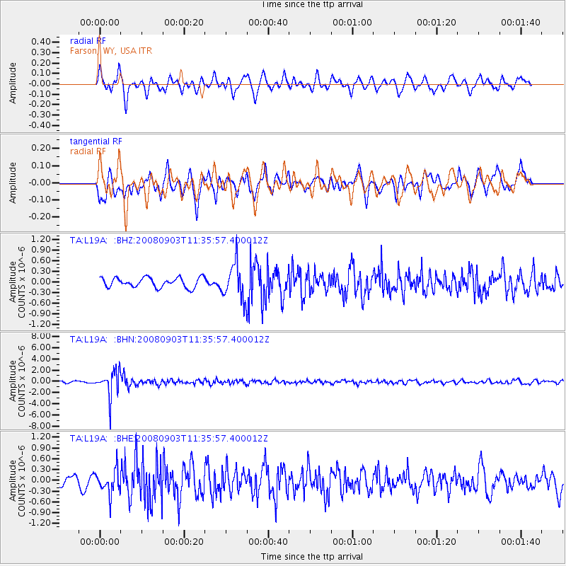
L19A Farson, WY, USA - Earthquake Result Viewer
*The percent match for this event was below the threshold and hence no stack was calculated.
| Earthquake location: |
Santiago Del Estero Prov., Arg. |
| Earthquake latitude/longitude: |
-26.7/-63.2 |
| Earthquake time(UTC): |
2008/09/03 (247) 11:25:14 GMT |
| Earthquake Depth: |
570 km |
| Earthquake Magnitude: |
5.9 MB, 6.3 MW, 6.3 MW |
| Earthquake Catalog/Contributor: |
WHDF/NEIC |
|
| Network: |
TA USArray Transportable Network (new EarthScope stations) |
| Station: |
L19A Farson, WY, USA |
| Lat/Lon: |
42.10 N/109.36 W |
| Elevation: |
2034 m |
|
| Distance: |
80.7 deg |
| Az: |
327.062 deg |
| Baz: |
139.201 deg |
| Ray Param: |
$rayparam |
*The percent match for this event was below the threshold and hence was not used in the summary stack. |
|
| Radial Match: |
63.48956 % |
| Radial Bump: |
400 |
| Transverse Match: |
64.70036 % |
| Transverse Bump: |
400 |
| SOD ConfigId: |
2504 |
| Insert Time: |
2010-03-06 00:48:51.563 +0000 |
| GWidth: |
2.5 |
| Max Bumps: |
400 |
| Tol: |
0.001 |
|
Signal To Noise
| Channel | StoN | STA | LTA |
| TA:L19A: :BHN:20080903T11:35:57.400012Z | 9.528658 | 2.3170699E-6 | 2.4316853E-7 |
| TA:L19A: :BHE:20080903T11:35:57.400012Z | 1.9129424 | 3.3598482E-7 | 1.7563771E-7 |
| TA:L19A: :BHZ:20080903T11:35:57.400012Z | 3.7068634 | 5.097714E-7 | 1.3752096E-7 |
| Arrivals |
| Ps | |
| PpPs | |
| PsPs/PpSs | |


