You are here: Home > Network List > TA - USArray Transportable Network (new EarthScope stations) Stations List
> Station L19A Farson, WY, USA > Earthquake Result Viewer
L19A Farson, WY, USA - Earthquake Result Viewer
*The percent match for this event was below the threshold and hence no stack was calculated.
| Earthquake location: |
Colombia |
| Earthquake latitude/longitude: |
4.8/-75.5 |
| Earthquake time(UTC): |
2008/09/13 (257) 09:32:01 GMT |
| Earthquake Depth: |
133 km |
| Earthquake Magnitude: |
5.9 MB, 5.7 MW, 5.7 MW |
| Earthquake Catalog/Contributor: |
WHDF/NEIC |
|
| Network: |
TA USArray Transportable Network (new EarthScope stations) |
| Station: |
L19A Farson, WY, USA |
| Lat/Lon: |
42.10 N/109.36 W |
| Elevation: |
2034 m |
|
| Distance: |
47.8 deg |
| Az: |
325.999 deg |
| Baz: |
131.51 deg |
| Ray Param: |
$rayparam |
*The percent match for this event was below the threshold and hence was not used in the summary stack. |
|
| Radial Match: |
46.93447 % |
| Radial Bump: |
400 |
| Transverse Match: |
52.34231 % |
| Transverse Bump: |
400 |
| SOD ConfigId: |
2560 |
| Insert Time: |
2010-03-06 00:48:55.607 +0000 |
| GWidth: |
2.5 |
| Max Bumps: |
400 |
| Tol: |
0.001 |
|
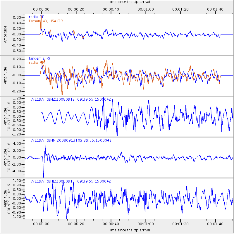
Signal To Noise
| Channel | StoN | STA | LTA |
| TA:L19A: :BHN:20080913T09:39:55.150004Z | 8.631965 | 1.7606517E-6 | 2.0396881E-7 |
| TA:L19A: :BHE:20080913T09:39:55.150004Z | 1.673028 | 3.3700385E-7 | 2.0143348E-7 |
| TA:L19A: :BHZ:20080913T09:39:55.150004Z | 1.5085036 | 3.6963016E-7 | 2.45031E-7 |
| Arrivals |
| Ps | |
| PpPs | |
| PsPs/PpSs | |


