You are here: Home > Network List > TA - USArray Transportable Network (new EarthScope stations) Stations List
> Station L19A Farson, WY, USA > Earthquake Result Viewer
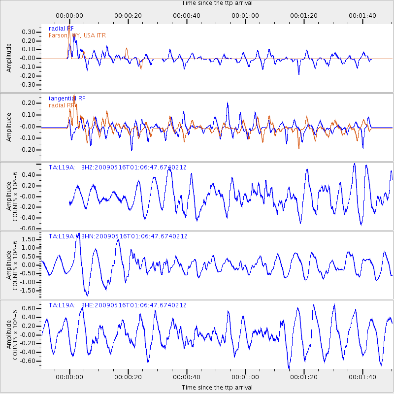
L19A Farson, WY, USA - Earthquake Result Viewer
*The percent match for this event was below the threshold and hence no stack was calculated.
| Earthquake location: |
Kermadec Islands Region |
| Earthquake latitude/longitude: |
-31.5/-178.8 |
| Earthquake time(UTC): |
2009/05/16 (136) 00:53:52 GMT |
| Earthquake Depth: |
55 km |
| Earthquake Magnitude: |
6.1 MB, 6.5 MW, 6.3 MW |
| Earthquake Catalog/Contributor: |
WHDF/NEIC |
|
| Network: |
TA USArray Transportable Network (new EarthScope stations) |
| Station: |
L19A Farson, WY, USA |
| Lat/Lon: |
42.10 N/109.36 W |
| Elevation: |
2034 m |
|
| Distance: |
97.1 deg |
| Az: |
44.605 deg |
| Baz: |
233.692 deg |
| Ray Param: |
$rayparam |
*The percent match for this event was below the threshold and hence was not used in the summary stack. |
|
| Radial Match: |
81.30664 % |
| Radial Bump: |
400 |
| Transverse Match: |
73.48372 % |
| Transverse Bump: |
400 |
| SOD ConfigId: |
2760 |
| Insert Time: |
2010-03-06 00:49:08.785 +0000 |
| GWidth: |
2.5 |
| Max Bumps: |
400 |
| Tol: |
0.001 |
|
Signal To Noise
| Channel | StoN | STA | LTA |
| TA:L19A: :BHN:20090516T01:06:47.674021Z | 5.6012383 | 9.822486E-7 | 1.7536277E-7 |
| TA:L19A: :BHE:20090516T01:06:47.674021Z | 2.0552516 | 3.8477071E-7 | 1.8721343E-7 |
| TA:L19A: :BHZ:20090516T01:06:47.674021Z | 2.5002723 | 3.152943E-7 | 1.2610398E-7 |
| Arrivals |
| Ps | |
| PpPs | |
| PsPs/PpSs | |


