You are here: Home > Network List > TA - USArray Transportable Network (new EarthScope stations) Stations List
> Station L19A Farson, WY, USA > Earthquake Result Viewer
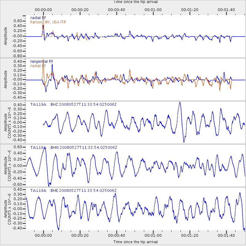
L19A Farson, WY, USA - Earthquake Result Viewer
*The percent match for this event was below the threshold and hence no stack was calculated.
| Earthquake location: |
Near Coast Of Guatemala |
| Earthquake latitude/longitude: |
13.6/-91.0 |
| Earthquake time(UTC): |
2008/05/27 (148) 11:27:55 GMT |
| Earthquake Depth: |
26 km |
| Earthquake Magnitude: |
5.7 MW, 5.1 MS, 5.3 MB, 5.6 MW |
| Earthquake Catalog/Contributor: |
WHDF/NEIC |
|
| Network: |
TA USArray Transportable Network (new EarthScope stations) |
| Station: |
L19A Farson, WY, USA |
| Lat/Lon: |
42.10 N/109.36 W |
| Elevation: |
2034 m |
|
| Distance: |
32.5 deg |
| Az: |
334.193 deg |
| Baz: |
145.337 deg |
| Ray Param: |
$rayparam |
*The percent match for this event was below the threshold and hence was not used in the summary stack. |
|
| Radial Match: |
60.035942 % |
| Radial Bump: |
400 |
| Transverse Match: |
72.16452 % |
| Transverse Bump: |
301 |
| SOD ConfigId: |
2504 |
| Insert Time: |
2010-03-06 00:49:31.927 +0000 |
| GWidth: |
2.5 |
| Max Bumps: |
400 |
| Tol: |
0.001 |
|
Signal To Noise
| Channel | StoN | STA | LTA |
| TA:L19A: :BHN:20080527T11:33:54.025006Z | 3.4613307 | 4.664653E-7 | 1.3476473E-7 |
| TA:L19A: :BHE:20080527T11:33:54.025006Z | 0.82651705 | 1.2758026E-7 | 1.5435891E-7 |
| TA:L19A: :BHZ:20080527T11:33:54.025006Z | 1.503005 | 1.8032412E-7 | 1.1997574E-7 |
| Arrivals |
| Ps | |
| PpPs | |
| PsPs/PpSs | |


