You are here: Home > Network List > TA - USArray Transportable Network (new EarthScope stations) Stations List
> Station L19A Farson, WY, USA > Earthquake Result Viewer
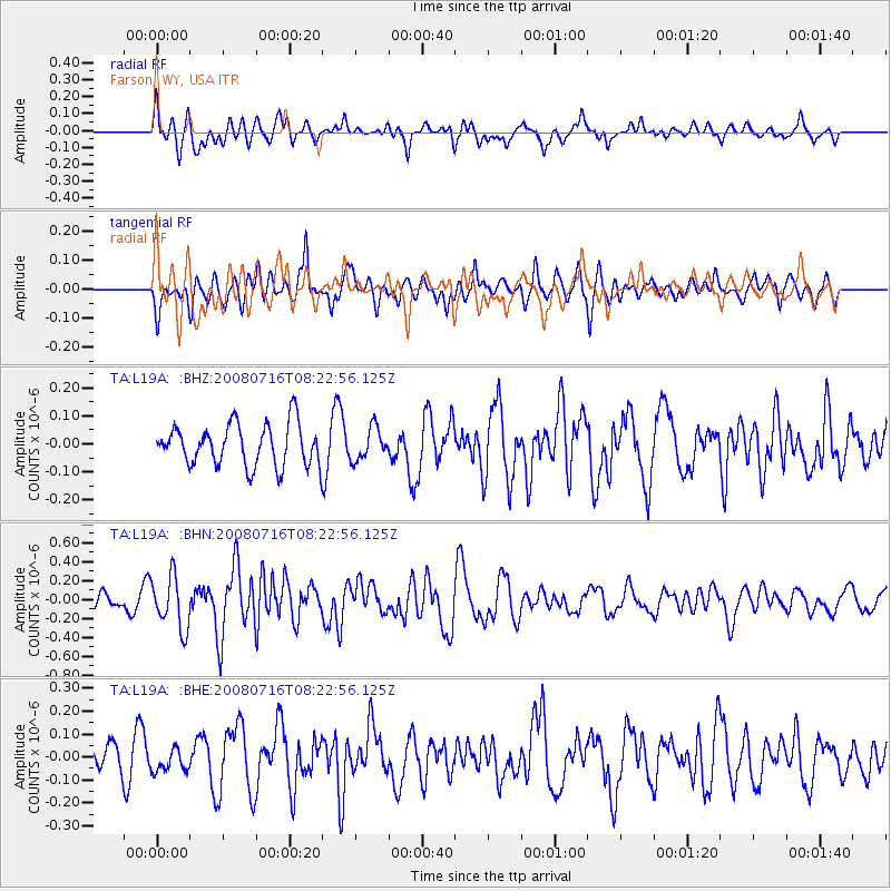
L19A Farson, WY, USA - Earthquake Result Viewer
*The percent match for this event was below the threshold and hence no stack was calculated.
| Earthquake location: |
Samoa Islands Region |
| Earthquake latitude/longitude: |
-16.6/-173.0 |
| Earthquake time(UTC): |
2008/07/16 (198) 08:11:04 GMT |
| Earthquake Depth: |
10 km |
| Earthquake Magnitude: |
5.5 MB, 5.4 MS, 5.7 MW, 5.7 MW |
| Earthquake Catalog/Contributor: |
WHDF/NEIC |
|
| Network: |
TA USArray Transportable Network (new EarthScope stations) |
| Station: |
L19A Farson, WY, USA |
| Lat/Lon: |
42.10 N/109.36 W |
| Elevation: |
2034 m |
|
| Distance: |
82.7 deg |
| Az: |
42.23 deg |
| Baz: |
239.994 deg |
| Ray Param: |
$rayparam |
*The percent match for this event was below the threshold and hence was not used in the summary stack. |
|
| Radial Match: |
62.693928 % |
| Radial Bump: |
400 |
| Transverse Match: |
55.976498 % |
| Transverse Bump: |
377 |
| SOD ConfigId: |
2504 |
| Insert Time: |
2010-03-06 00:49:42.891 +0000 |
| GWidth: |
2.5 |
| Max Bumps: |
400 |
| Tol: |
0.001 |
|
Signal To Noise
| Channel | StoN | STA | LTA |
| TA:L19A: :BHN:20080716T08:22:56.125Z | 3.5974894 | 2.766194E-7 | 7.689235E-8 |
| TA:L19A: :BHE:20080716T08:22:56.125Z | 0.78296244 | 4.9576897E-8 | 6.331964E-8 |
| TA:L19A: :BHZ:20080716T08:22:56.125Z | 0.76538026 | 5.655886E-8 | 7.389642E-8 |
| Arrivals |
| Ps | |
| PpPs | |
| PsPs/PpSs | |


