You are here: Home > Network List > TA - USArray Transportable Network (new EarthScope stations) Stations List
> Station L19A Farson, WY, USA > Earthquake Result Viewer
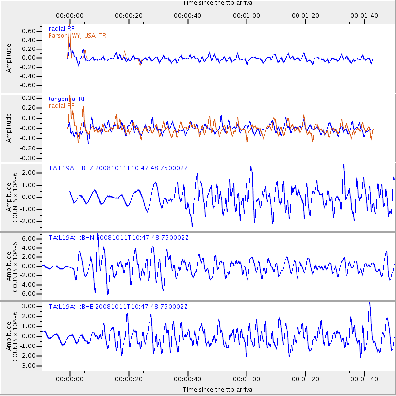
L19A Farson, WY, USA - Earthquake Result Viewer
*The percent match for this event was below the threshold and hence no stack was calculated.
| Earthquake location: |
Virgin Islands |
| Earthquake latitude/longitude: |
19.2/-64.8 |
| Earthquake time(UTC): |
2008/10/11 (285) 10:40:14 GMT |
| Earthquake Depth: |
23 km |
| Earthquake Magnitude: |
6.1 MB, 5.9 MS, 6.1 MW, 6.0 MW |
| Earthquake Catalog/Contributor: |
WHDF/NEIC |
|
| Network: |
TA USArray Transportable Network (new EarthScope stations) |
| Station: |
L19A Farson, WY, USA |
| Lat/Lon: |
42.10 N/109.36 W |
| Elevation: |
2034 m |
|
| Distance: |
44.0 deg |
| Az: |
311.291 deg |
| Baz: |
107.372 deg |
| Ray Param: |
$rayparam |
*The percent match for this event was below the threshold and hence was not used in the summary stack. |
|
| Radial Match: |
72.64525 % |
| Radial Bump: |
400 |
| Transverse Match: |
60.58228 % |
| Transverse Bump: |
400 |
| SOD ConfigId: |
2556 |
| Insert Time: |
2010-03-06 00:49:48.350 +0000 |
| GWidth: |
2.5 |
| Max Bumps: |
400 |
| Tol: |
0.001 |
|
Signal To Noise
| Channel | StoN | STA | LTA |
| TA:L19A: :BHN:20081011T10:47:48.750002Z | 4.148261 | 1.5669035E-6 | 3.777254E-7 |
| TA:L19A: :BHE:20081011T10:47:48.750002Z | 0.6757704 | 2.8130032E-7 | 4.162661E-7 |
| TA:L19A: :BHZ:20081011T10:47:48.750002Z | 1.7207094 | 5.800275E-7 | 3.3708625E-7 |
| Arrivals |
| Ps | |
| PpPs | |
| PsPs/PpSs | |


