You are here: Home > Network List > TA - USArray Transportable Network (new EarthScope stations) Stations List
> Station L19A Farson, WY, USA > Earthquake Result Viewer
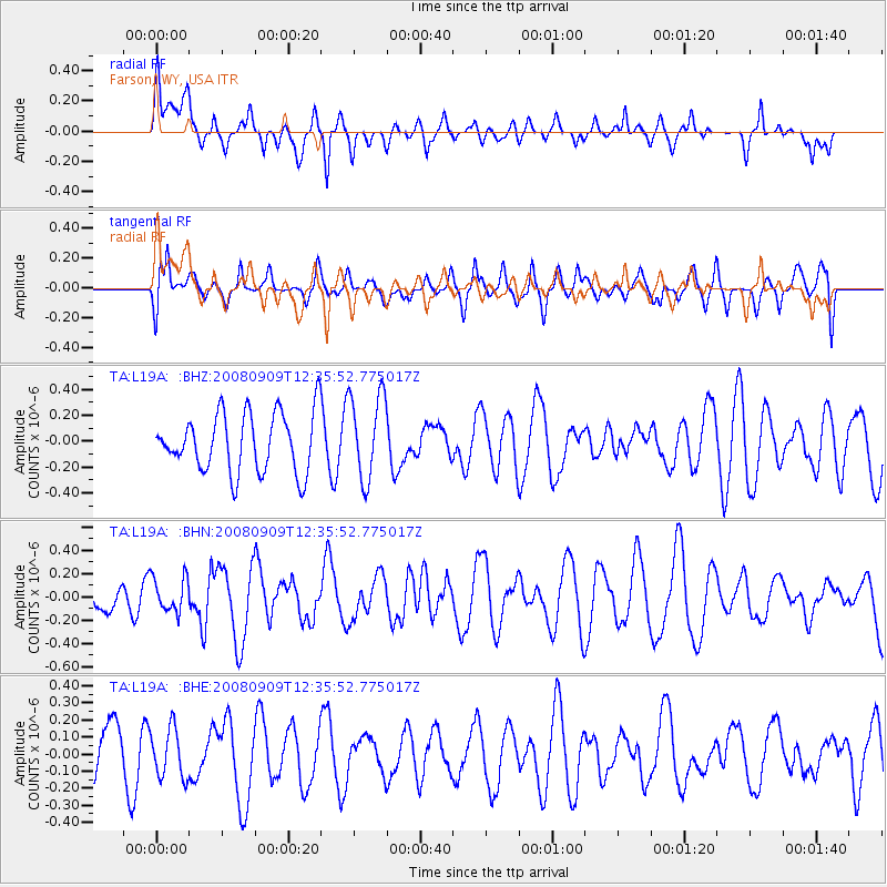
L19A Farson, WY, USA - Earthquake Result Viewer
*The percent match for this event was below the threshold and hence no stack was calculated.
| Earthquake location: |
Solomon Islands |
| Earthquake latitude/longitude: |
-9.3/158.3 |
| Earthquake time(UTC): |
2008/09/09 (253) 12:22:49 GMT |
| Earthquake Depth: |
12 km |
| Earthquake Magnitude: |
5.7 MB, 5.6 MS, 5.9 MW, 5.9 MW |
| Earthquake Catalog/Contributor: |
WHDF/NEIC |
|
| Network: |
TA USArray Transportable Network (new EarthScope stations) |
| Station: |
L19A Farson, WY, USA |
| Lat/Lon: |
42.10 N/109.36 W |
| Elevation: |
2034 m |
|
| Distance: |
97.9 deg |
| Az: |
48.649 deg |
| Baz: |
264.687 deg |
| Ray Param: |
$rayparam |
*The percent match for this event was below the threshold and hence was not used in the summary stack. |
|
| Radial Match: |
59.14492 % |
| Radial Bump: |
400 |
| Transverse Match: |
50.75856 % |
| Transverse Bump: |
400 |
| SOD ConfigId: |
2560 |
| Insert Time: |
2010-03-06 00:49:49.549 +0000 |
| GWidth: |
2.5 |
| Max Bumps: |
400 |
| Tol: |
0.001 |
|
Signal To Noise
| Channel | StoN | STA | LTA |
| TA:L19A: :BHN:20080909T12:35:52.775017Z | 0.86030984 | 1.4905308E-7 | 1.7325512E-7 |
| TA:L19A: :BHE:20080909T12:35:52.775017Z | 0.68260235 | 1.4331381E-7 | 2.0995213E-7 |
| TA:L19A: :BHZ:20080909T12:35:52.775017Z | 1.4667304 | 3.3238268E-7 | 2.2661472E-7 |
| Arrivals |
| Ps | |
| PpPs | |
| PsPs/PpSs | |


