You are here: Home > Network List > TA - USArray Transportable Network (new EarthScope stations) Stations List
> Station L19A Farson, WY, USA > Earthquake Result Viewer
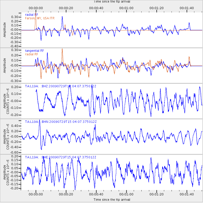
L19A Farson, WY, USA - Earthquake Result Viewer
*The percent match for this event was below the threshold and hence no stack was calculated.
| Earthquake location: |
Volcano Islands, Japan Region |
| Earthquake latitude/longitude: |
22.6/143.3 |
| Earthquake time(UTC): |
2009/07/29 (210) 14:52:08 GMT |
| Earthquake Depth: |
140 km |
| Earthquake Magnitude: |
5.5 MW, 5.2 MB, 5.4 MW |
| Earthquake Catalog/Contributor: |
WHDF/NEIC |
|
| Network: |
TA USArray Transportable Network (new EarthScope stations) |
| Station: |
L19A Farson, WY, USA |
| Lat/Lon: |
42.10 N/109.36 W |
| Elevation: |
2034 m |
|
| Distance: |
87.2 deg |
| Az: |
45.324 deg |
| Baz: |
297.97 deg |
| Ray Param: |
$rayparam |
*The percent match for this event was below the threshold and hence was not used in the summary stack. |
|
| Radial Match: |
51.033905 % |
| Radial Bump: |
400 |
| Transverse Match: |
58.277355 % |
| Transverse Bump: |
369 |
| SOD ConfigId: |
2622 |
| Insert Time: |
2010-03-06 00:49:53.757 +0000 |
| GWidth: |
2.5 |
| Max Bumps: |
400 |
| Tol: |
0.001 |
|
Signal To Noise
| Channel | StoN | STA | LTA |
| TA:L19A: :BHN:20090729T15:04:07.375012Z | 3.3635676 | 2.7500892E-7 | 8.176108E-8 |
| TA:L19A: :BHE:20090729T15:04:07.375012Z | 0.8300187 | 7.415403E-8 | 8.934019E-8 |
| TA:L19A: :BHZ:20090729T15:04:07.375012Z | 0.36087134 | 3.840288E-8 | 1.064171E-7 |
| Arrivals |
| Ps | |
| PpPs | |
| PsPs/PpSs | |


