You are here: Home > Network List > TA - USArray Transportable Network (new EarthScope stations) Stations List
> Station L19A Farson, WY, USA > Earthquake Result Viewer
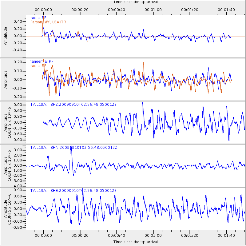
L19A Farson, WY, USA - Earthquake Result Viewer
*The percent match for this event was below the threshold and hence no stack was calculated.
| Earthquake location: |
Kuril Islands |
| Earthquake latitude/longitude: |
48.3/154.2 |
| Earthquake time(UTC): |
2009/09/10 (253) 02:46:50 GMT |
| Earthquake Depth: |
36 km |
| Earthquake Magnitude: |
6.0 MB, 5.5 MS, 6.0 MW, 5.8 MW |
| Earthquake Catalog/Contributor: |
WHDF/NEIC |
|
| Network: |
TA USArray Transportable Network (new EarthScope stations) |
| Station: |
L19A Farson, WY, USA |
| Lat/Lon: |
42.10 N/109.36 W |
| Elevation: |
2034 m |
|
| Distance: |
63.8 deg |
| Az: |
55.506 deg |
| Baz: |
312.333 deg |
| Ray Param: |
$rayparam |
*The percent match for this event was below the threshold and hence was not used in the summary stack. |
|
| Radial Match: |
75.73571 % |
| Radial Bump: |
400 |
| Transverse Match: |
74.189514 % |
| Transverse Bump: |
400 |
| SOD ConfigId: |
2622 |
| Insert Time: |
2010-03-06 00:50:05.934 +0000 |
| GWidth: |
2.5 |
| Max Bumps: |
400 |
| Tol: |
0.001 |
|
Signal To Noise
| Channel | StoN | STA | LTA |
| TA:L19A: :BHN:20090910T02:56:48.050012Z | 3.8255038 | 8.138755E-7 | 2.1274988E-7 |
| TA:L19A: :BHE:20090910T02:56:48.050012Z | 1.1909292 | 1.8503373E-7 | 1.5536921E-7 |
| TA:L19A: :BHZ:20090910T02:56:48.050012Z | 0.9122457 | 1.5191537E-7 | 1.66529E-7 |
| Arrivals |
| Ps | |
| PpPs | |
| PsPs/PpSs | |


