You are here: Home > Network List > UU - University of Utah Regional Network Stations List
> Station CCUT Cedar City, UT, USA > Earthquake Result Viewer
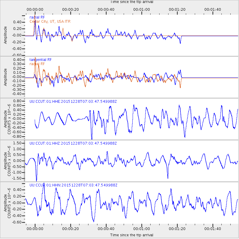
CCUT Cedar City, UT, USA - Earthquake Result Viewer
*The percent match for this event was below the threshold and hence no stack was calculated.
| Earthquake location: |
Windward Islands |
| Earthquake latitude/longitude: |
14.6/-61.4 |
| Earthquake time(UTC): |
2015/12/28 (362) 06:55:30 GMT |
| Earthquake Depth: |
153 km |
| Earthquake Magnitude: |
5.6 MWP |
| Earthquake Catalog/Contributor: |
NEIC PDE/NEIC COMCAT |
|
| Network: |
UU University of Utah Regional Network |
| Station: |
CCUT Cedar City, UT, USA |
| Lat/Lon: |
37.55 N/113.36 W |
| Elevation: |
2127 m |
|
| Distance: |
51.3 deg |
| Az: |
306.597 deg |
| Baz: |
102.048 deg |
| Ray Param: |
$rayparam |
*The percent match for this event was below the threshold and hence was not used in the summary stack. |
|
| Radial Match: |
74.57932 % |
| Radial Bump: |
400 |
| Transverse Match: |
65.133484 % |
| Transverse Bump: |
382 |
| SOD ConfigId: |
1259291 |
| Insert Time: |
2016-01-11 07:39:18.626 +0000 |
| GWidth: |
2.5 |
| Max Bumps: |
400 |
| Tol: |
0.001 |
|
Signal To Noise
| Channel | StoN | STA | LTA |
| UU:CCUT:01:HHZ:20151228T07:03:47.549988Z | 3.1054163 | 5.661893E-7 | 1.8232316E-7 |
| UU:CCUT:01:HHN:20151228T07:03:47.549988Z | 3.2667377 | 2.458152E-7 | 7.524791E-8 |
| UU:CCUT:01:HHE:20151228T07:03:47.549988Z | 1.9255751 | 3.4411877E-7 | 1.787096E-7 |
| Arrivals |
| Ps | |
| PpPs | |
| PsPs/PpSs | |


