You are here: Home > Network List > TA - USArray Transportable Network (new EarthScope stations) Stations List
> Station M11K Mekoryuk, AK, USA > Earthquake Result Viewer
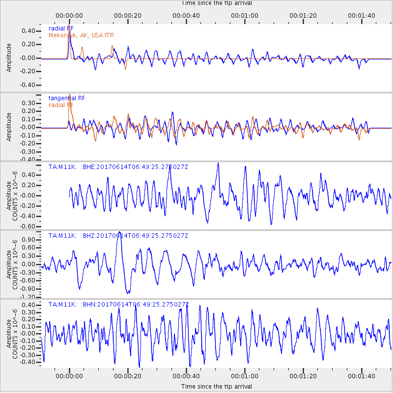
M11K Mekoryuk, AK, USA - Earthquake Result Viewer
*The percent match for this event was below the threshold and hence no stack was calculated.
| Earthquake location: |
Near Coast Of Chiapas, Mexico |
| Earthquake latitude/longitude: |
14.2/-93.2 |
| Earthquake time(UTC): |
2017/06/14 (165) 06:38:48 GMT |
| Earthquake Depth: |
11 km |
| Earthquake Magnitude: |
5.5 Mww |
| Earthquake Catalog/Contributor: |
NEIC PDE/us |
|
| Network: |
TA USArray Transportable Network (new EarthScope stations) |
| Station: |
M11K Mekoryuk, AK, USA |
| Lat/Lon: |
60.38 N/166.20 W |
| Elevation: |
3.0 m |
|
| Distance: |
69.4 deg |
| Az: |
329.492 deg |
| Baz: |
97.619 deg |
| Ray Param: |
$rayparam |
*The percent match for this event was below the threshold and hence was not used in the summary stack. |
|
| Radial Match: |
73.38271 % |
| Radial Bump: |
400 |
| Transverse Match: |
63.491344 % |
| Transverse Bump: |
400 |
| SOD ConfigId: |
13570011 |
| Insert Time: |
2019-04-28 04:58:46.956 +0000 |
| GWidth: |
2.5 |
| Max Bumps: |
400 |
| Tol: |
0.001 |
|
Signal To Noise
| Channel | StoN | STA | LTA |
| TA:M11K: :BHZ:20170614T06:49:25.275027Z | 3.4305832 | 4.401274E-7 | 1.2829521E-7 |
| TA:M11K: :BHN:20170614T06:49:25.275027Z | 0.7075884 | 9.8403646E-8 | 1.3906906E-7 |
| TA:M11K: :BHE:20170614T06:49:25.275027Z | 1.7606137 | 2.7164268E-7 | 1.5428863E-7 |
| Arrivals |
| Ps | |
| PpPs | |
| PsPs/PpSs | |


