You are here: Home > Network List > TA - USArray Transportable Network (new EarthScope stations) Stations List
> Station L19A Farson, WY, USA > Earthquake Result Viewer
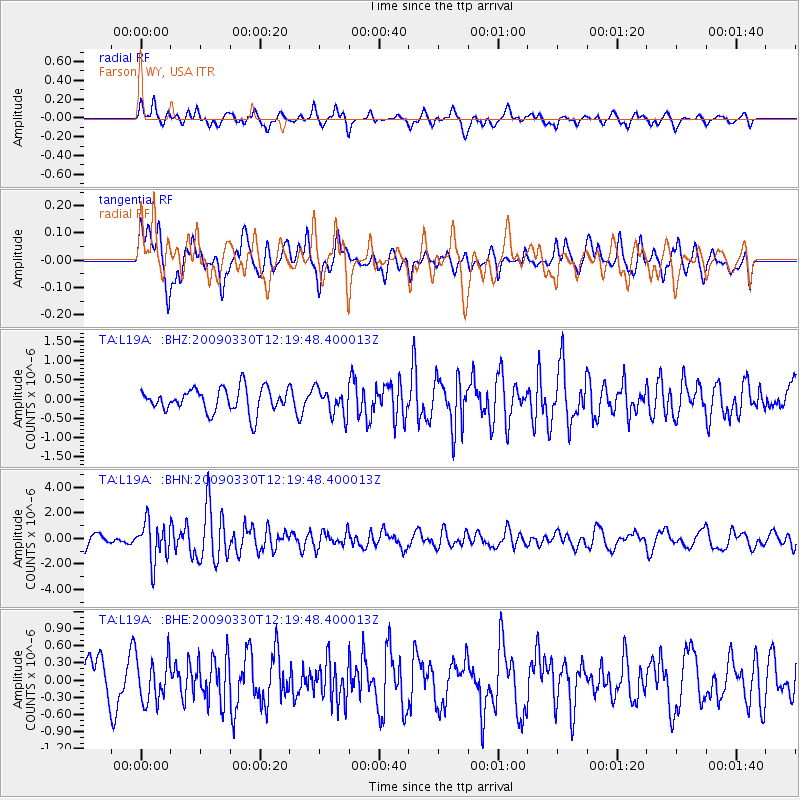
L19A Farson, WY, USA - Earthquake Result Viewer
*The percent match for this event was below the threshold and hence no stack was calculated.
| Earthquake location: |
Andreanof Islands, Aleutian Is. |
| Earthquake latitude/longitude: |
51.5/-178.3 |
| Earthquake time(UTC): |
2009/03/30 (089) 12:11:54 GMT |
| Earthquake Depth: |
31 km |
| Earthquake Magnitude: |
6.0 MB, 5.8 MW, 5.7 MW |
| Earthquake Catalog/Contributor: |
WHDF/NEIC |
|
| Network: |
TA USArray Transportable Network (new EarthScope stations) |
| Station: |
L19A Farson, WY, USA |
| Lat/Lon: |
42.10 N/109.36 W |
| Elevation: |
2034 m |
|
| Distance: |
46.5 deg |
| Az: |
73.31 deg |
| Baz: |
306.478 deg |
| Ray Param: |
$rayparam |
*The percent match for this event was below the threshold and hence was not used in the summary stack. |
|
| Radial Match: |
67.26773 % |
| Radial Bump: |
400 |
| Transverse Match: |
57.855175 % |
| Transverse Bump: |
400 |
| SOD ConfigId: |
2658 |
| Insert Time: |
2010-03-06 00:50:58.418 +0000 |
| GWidth: |
2.5 |
| Max Bumps: |
400 |
| Tol: |
0.001 |
|
Signal To Noise
| Channel | StoN | STA | LTA |
| TA:L19A: :BHN:20090330T12:19:48.400013Z | 3.6557057 | 1.5299731E-6 | 4.185165E-7 |
| TA:L19A: :BHE:20090330T12:19:48.400013Z | 0.80557674 | 3.801235E-7 | 4.7186504E-7 |
| TA:L19A: :BHZ:20090330T12:19:48.400013Z | 1.1180811 | 3.4660732E-7 | 3.1000198E-7 |
| Arrivals |
| Ps | |
| PpPs | |
| PsPs/PpSs | |


