You are here: Home > Network List > TA - USArray Transportable Network (new EarthScope stations) Stations List
> Station L19A Farson, WY, USA > Earthquake Result Viewer
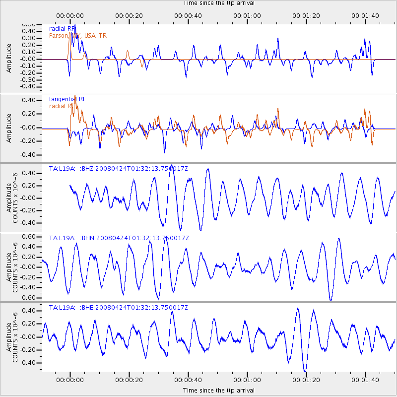
L19A Farson, WY, USA - Earthquake Result Viewer
*The percent match for this event was below the threshold and hence no stack was calculated.
| Earthquake location: |
Loyalty Islands |
| Earthquake latitude/longitude: |
-20.1/168.7 |
| Earthquake time(UTC): |
2008/04/24 (115) 01:19:15 GMT |
| Earthquake Depth: |
35 km |
| Earthquake Magnitude: |
5.7 MW, 5.3 MS, 5.3 MB, 5.6 MW |
| Earthquake Catalog/Contributor: |
WHDF/NEIC |
|
| Network: |
TA USArray Transportable Network (new EarthScope stations) |
| Station: |
L19A Farson, WY, USA |
| Lat/Lon: |
42.10 N/109.36 W |
| Elevation: |
2034 m |
|
| Distance: |
97.4 deg |
| Az: |
47.993 deg |
| Baz: |
249.826 deg |
| Ray Param: |
$rayparam |
*The percent match for this event was below the threshold and hence was not used in the summary stack. |
|
| Radial Match: |
63.28988 % |
| Radial Bump: |
400 |
| Transverse Match: |
63.562622 % |
| Transverse Bump: |
400 |
| SOD ConfigId: |
2504 |
| Insert Time: |
2010-03-06 00:51:17.624 +0000 |
| GWidth: |
2.5 |
| Max Bumps: |
400 |
| Tol: |
0.001 |
|
Signal To Noise
| Channel | StoN | STA | LTA |
| TA:L19A: :BHN:20080424T01:32:13.750017Z | 2.7099988 | 3.3158662E-7 | 1.2235674E-7 |
| TA:L19A: :BHE:20080424T01:32:13.750017Z | 1.15016 | 1.3931405E-7 | 1.2112581E-7 |
| TA:L19A: :BHZ:20080424T01:32:13.750017Z | 2.9713585 | 3.5474636E-7 | 1.193886E-7 |
| Arrivals |
| Ps | |
| PpPs | |
| PsPs/PpSs | |


