You are here: Home > Network List > UW - Pacific Northwest Regional Seismic Network Stations List
> Station FISH Seaside, OR, USA > Earthquake Result Viewer
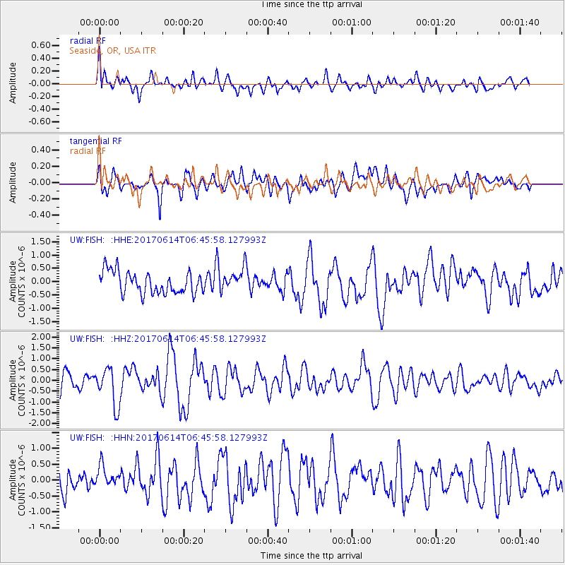
FISH Seaside, OR, USA - Earthquake Result Viewer
*The percent match for this event was below the threshold and hence no stack was calculated.
| Earthquake location: |
Near Coast Of Chiapas, Mexico |
| Earthquake latitude/longitude: |
14.2/-93.2 |
| Earthquake time(UTC): |
2017/06/14 (165) 06:38:48 GMT |
| Earthquake Depth: |
11 km |
| Earthquake Magnitude: |
5.5 Mww |
| Earthquake Catalog/Contributor: |
NEIC PDE/us |
|
| Network: |
UW Pacific Northwest Regional Seismic Network |
| Station: |
FISH Seaside, OR, USA |
| Lat/Lon: |
45.93 N/123.56 W |
| Elevation: |
325 m |
|
| Distance: |
40.7 deg |
| Az: |
327.168 deg |
| Baz: |
131.122 deg |
| Ray Param: |
$rayparam |
*The percent match for this event was below the threshold and hence was not used in the summary stack. |
|
| Radial Match: |
60.398735 % |
| Radial Bump: |
400 |
| Transverse Match: |
60.560204 % |
| Transverse Bump: |
400 |
| SOD ConfigId: |
13570011 |
| Insert Time: |
2019-04-28 04:59:59.195 +0000 |
| GWidth: |
2.5 |
| Max Bumps: |
400 |
| Tol: |
0.001 |
|
Signal To Noise
| Channel | StoN | STA | LTA |
| UW:FISH: :HHZ:20170614T06:45:58.127993Z | 2.6728656 | 9.047939E-7 | 3.3851083E-7 |
| UW:FISH: :HHN:20170614T06:45:58.127993Z | 0.84532195 | 3.2494913E-7 | 3.8440874E-7 |
| UW:FISH: :HHE:20170614T06:45:58.127993Z | 1.0560712 | 4.3286514E-7 | 4.0988255E-7 |
| Arrivals |
| Ps | |
| PpPs | |
| PsPs/PpSs | |


