You are here: Home > Network List > UW - Pacific Northwest Regional Seismic Network Stations List
> Station MRBL Marblemount, WA, USA > Earthquake Result Viewer
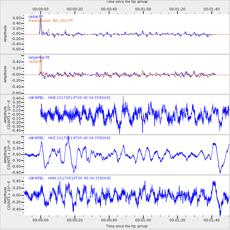
MRBL Marblemount, WA, USA - Earthquake Result Viewer
*The percent match for this event was below the threshold and hence no stack was calculated.
| Earthquake location: |
Near Coast Of Chiapas, Mexico |
| Earthquake latitude/longitude: |
14.2/-93.2 |
| Earthquake time(UTC): |
2017/06/14 (165) 06:38:48 GMT |
| Earthquake Depth: |
11 km |
| Earthquake Magnitude: |
5.5 Mww |
| Earthquake Catalog/Contributor: |
NEIC PDE/us |
|
| Network: |
UW Pacific Northwest Regional Seismic Network |
| Station: |
MRBL Marblemount, WA, USA |
| Lat/Lon: |
48.52 N/121.48 W |
| Elevation: |
75 m |
|
| Distance: |
41.4 deg |
| Az: |
331.511 deg |
| Baz: |
135.917 deg |
| Ray Param: |
$rayparam |
*The percent match for this event was below the threshold and hence was not used in the summary stack. |
|
| Radial Match: |
79.77705 % |
| Radial Bump: |
395 |
| Transverse Match: |
61.496998 % |
| Transverse Bump: |
400 |
| SOD ConfigId: |
13570011 |
| Insert Time: |
2019-04-28 05:00:09.268 +0000 |
| GWidth: |
2.5 |
| Max Bumps: |
400 |
| Tol: |
0.001 |
|
Signal To Noise
| Channel | StoN | STA | LTA |
| UW:MRBL: :HHZ:20170614T06:46:04.358004Z | 4.901348 | 4.2634915E-7 | 8.69861E-8 |
| UW:MRBL: :HHN:20170614T06:46:04.358004Z | 2.1532338 | 1.7848996E-7 | 8.2893905E-8 |
| UW:MRBL: :HHE:20170614T06:46:04.358004Z | 1.5993015 | 1.3736053E-7 | 8.5887834E-8 |
| Arrivals |
| Ps | |
| PpPs | |
| PsPs/PpSs | |


