You are here: Home > Network List > UW - Pacific Northwest Regional Seismic Network Stations List
> Station YACT Amboy, WA, USA > Earthquake Result Viewer
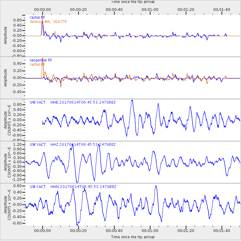
YACT Amboy, WA, USA - Earthquake Result Viewer
*The percent match for this event was below the threshold and hence no stack was calculated.
| Earthquake location: |
Near Coast Of Chiapas, Mexico |
| Earthquake latitude/longitude: |
14.2/-93.2 |
| Earthquake time(UTC): |
2017/06/14 (165) 06:38:48 GMT |
| Earthquake Depth: |
11 km |
| Earthquake Magnitude: |
5.5 Mww |
| Earthquake Catalog/Contributor: |
NEIC PDE/us |
|
| Network: |
UW Pacific Northwest Regional Seismic Network |
| Station: |
YACT Amboy, WA, USA |
| Lat/Lon: |
45.93 N/122.42 W |
| Elevation: |
211 m |
|
| Distance: |
40.1 deg |
| Az: |
327.99 deg |
| Baz: |
132.565 deg |
| Ray Param: |
$rayparam |
*The percent match for this event was below the threshold and hence was not used in the summary stack. |
|
| Radial Match: |
79.42076 % |
| Radial Bump: |
400 |
| Transverse Match: |
67.937096 % |
| Transverse Bump: |
400 |
| SOD ConfigId: |
13570011 |
| Insert Time: |
2019-04-28 05:00:15.891 +0000 |
| GWidth: |
2.5 |
| Max Bumps: |
400 |
| Tol: |
0.001 |
|
Signal To Noise
| Channel | StoN | STA | LTA |
| UW:YACT: :HHZ:20170614T06:45:53.247988Z | 6.145746 | 5.8690927E-7 | 9.549846E-8 |
| UW:YACT: :HHN:20170614T06:45:53.247988Z | 1.3965694 | 1.7173775E-7 | 1.2297116E-7 |
| UW:YACT: :HHE:20170614T06:45:53.247988Z | 1.8281214 | 2.0308E-7 | 1.1108672E-7 |
| Arrivals |
| Ps | |
| PpPs | |
| PsPs/PpSs | |


