You are here: Home > Network List > TA - USArray Transportable Network (new EarthScope stations) Stations List
> Station L19A Farson, WY, USA > Earthquake Result Viewer
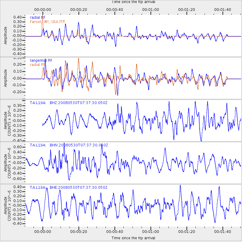
L19A Farson, WY, USA - Earthquake Result Viewer
*The percent match for this event was below the threshold and hence no stack was calculated.
| Earthquake location: |
Southeast Of Honshu, Japan |
| Earthquake latitude/longitude: |
30.8/141.5 |
| Earthquake time(UTC): |
2008/05/30 (151) 07:25:39 GMT |
| Earthquake Depth: |
16 km |
| Earthquake Magnitude: |
5.5 MB, 5.5 MS, 5.8 MW, 5.7 MW |
| Earthquake Catalog/Contributor: |
WHDF/NEIC |
|
| Network: |
TA USArray Transportable Network (new EarthScope stations) |
| Station: |
L19A Farson, WY, USA |
| Lat/Lon: |
42.10 N/109.36 W |
| Elevation: |
2034 m |
|
| Distance: |
82.5 deg |
| Az: |
45.172 deg |
| Baz: |
304.914 deg |
| Ray Param: |
$rayparam |
*The percent match for this event was below the threshold and hence was not used in the summary stack. |
|
| Radial Match: |
68.3698 % |
| Radial Bump: |
400 |
| Transverse Match: |
58.49404 % |
| Transverse Bump: |
400 |
| SOD ConfigId: |
2504 |
| Insert Time: |
2010-03-06 00:51:28.227 +0000 |
| GWidth: |
2.5 |
| Max Bumps: |
400 |
| Tol: |
0.001 |
|
Signal To Noise
| Channel | StoN | STA | LTA |
| TA:L19A: :BHN:20080530T07:37:30.050Z | 1.6581618 | 2.0609286E-7 | 1.2428997E-7 |
| TA:L19A: :BHE:20080530T07:37:30.050Z | 2.2843132 | 2.4806852E-7 | 1.0859654E-7 |
| TA:L19A: :BHZ:20080530T07:37:30.050Z | 0.9091212 | 9.291326E-8 | 1.02201184E-7 |
| Arrivals |
| Ps | |
| PpPs | |
| PsPs/PpSs | |


