You are here: Home > Network List > TA - USArray Transportable Network (new EarthScope stations) Stations List
> Station L19A Farson, WY, USA > Earthquake Result Viewer
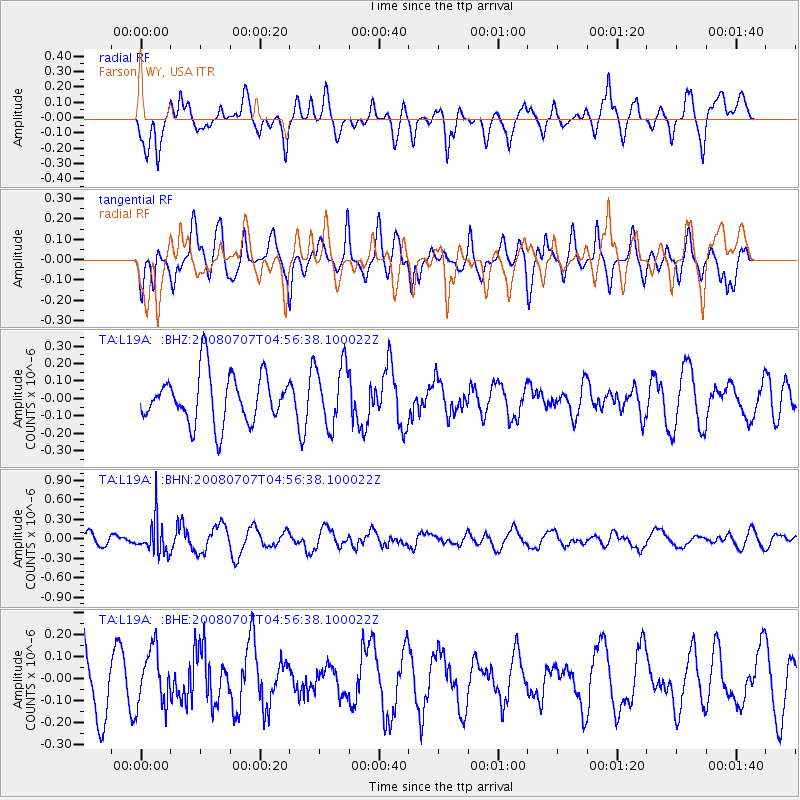
L19A Farson, WY, USA - Earthquake Result Viewer
*The percent match for this event was below the threshold and hence no stack was calculated.
| Earthquake location: |
Tonga Islands |
| Earthquake latitude/longitude: |
-16.4/-174.0 |
| Earthquake time(UTC): |
2008/07/07 (189) 04:44:55 GMT |
| Earthquake Depth: |
116 km |
| Earthquake Magnitude: |
5.5 MW, 5.0 MB, 5.5 MW |
| Earthquake Catalog/Contributor: |
WHDF/NEIC |
|
| Network: |
TA USArray Transportable Network (new EarthScope stations) |
| Station: |
L19A Farson, WY, USA |
| Lat/Lon: |
42.10 N/109.36 W |
| Elevation: |
2034 m |
|
| Distance: |
83.2 deg |
| Az: |
42.645 deg |
| Baz: |
240.882 deg |
| Ray Param: |
$rayparam |
*The percent match for this event was below the threshold and hence was not used in the summary stack. |
|
| Radial Match: |
56.613018 % |
| Radial Bump: |
400 |
| Transverse Match: |
53.6774 % |
| Transverse Bump: |
400 |
| SOD ConfigId: |
2504 |
| Insert Time: |
2010-03-06 00:51:37.489 +0000 |
| GWidth: |
2.5 |
| Max Bumps: |
400 |
| Tol: |
0.001 |
|
Signal To Noise
| Channel | StoN | STA | LTA |
| TA:L19A: :BHN:20080707T04:56:38.100022Z | 2.845401 | 2.6178253E-7 | 9.2001976E-8 |
| TA:L19A: :BHE:20080707T04:56:38.100022Z | 1.0423774 | 1.2643267E-7 | 1.2129262E-7 |
| TA:L19A: :BHZ:20080707T04:56:38.100022Z | 1.2562819 | 1.759269E-7 | 1.4003776E-7 |
| Arrivals |
| Ps | |
| PpPs | |
| PsPs/PpSs | |


