You are here: Home > Network List > WY - Yellowstone Wyoming Seismic Network Stations List
> Station YHH Holmes Hill, YNP, WY, USA > Earthquake Result Viewer
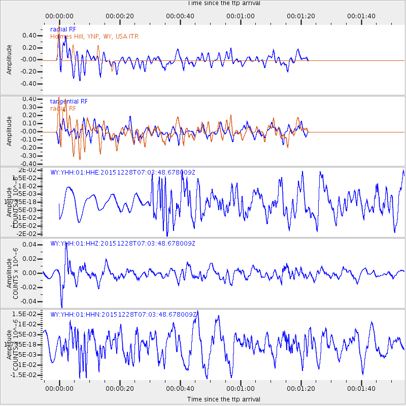
YHH Holmes Hill, YNP, WY, USA - Earthquake Result Viewer
*The percent match for this event was below the threshold and hence no stack was calculated.
| Earthquake location: |
Windward Islands |
| Earthquake latitude/longitude: |
14.6/-61.4 |
| Earthquake time(UTC): |
2015/12/28 (362) 06:55:30 GMT |
| Earthquake Depth: |
153 km |
| Earthquake Magnitude: |
5.6 MWP |
| Earthquake Catalog/Contributor: |
NEIC PDE/NEIC COMCAT |
|
| Network: |
WY Yellowstone Wyoming Seismic Network |
| Station: |
YHH Holmes Hill, YNP, WY, USA |
| Lat/Lon: |
44.79 N/110.85 W |
| Elevation: |
2717 m |
|
| Distance: |
51.4 deg |
| Az: |
316.172 deg |
| Baz: |
109.689 deg |
| Ray Param: |
$rayparam |
*The percent match for this event was below the threshold and hence was not used in the summary stack. |
|
| Radial Match: |
61.378685 % |
| Radial Bump: |
400 |
| Transverse Match: |
48.7731 % |
| Transverse Bump: |
400 |
| SOD ConfigId: |
1259291 |
| Insert Time: |
2016-01-11 07:41:59.016 +0000 |
| GWidth: |
2.5 |
| Max Bumps: |
400 |
| Tol: |
0.001 |
|
Signal To Noise
| Channel | StoN | STA | LTA |
| WY:YHH:01:HHZ:20151228T07:03:48.678009Z | 2.8861911 | 2.0662359E-8 | 7.15904E-9 |
| WY:YHH:01:HHN:20151228T07:03:48.678009Z | 1.5838159 | 4.7153743E-9 | 2.9772236E-9 |
| WY:YHH:01:HHE:20151228T07:03:48.678009Z | 1.6844329 | 9.092822E-9 | 5.3981504E-9 |
| Arrivals |
| Ps | |
| PpPs | |
| PsPs/PpSs | |


