You are here: Home > Network List > TA - USArray Transportable Network (new EarthScope stations) Stations List
> Station L19A Farson, WY, USA > Earthquake Result Viewer
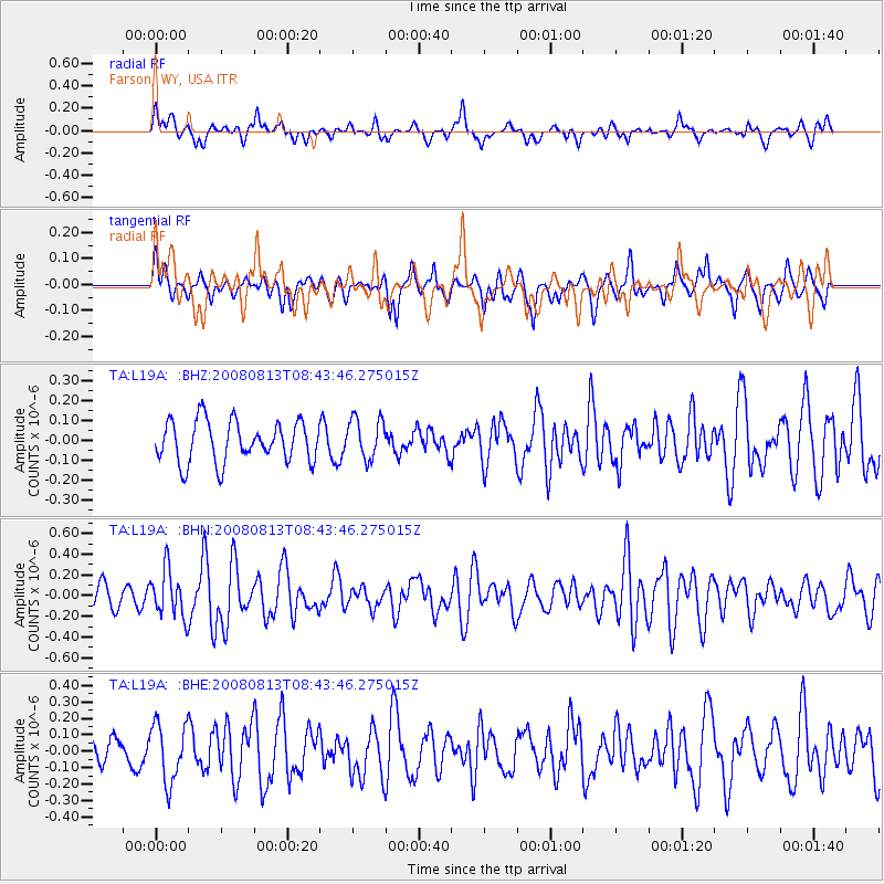
L19A Farson, WY, USA - Earthquake Result Viewer
*The percent match for this event was below the threshold and hence no stack was calculated.
| Earthquake location: |
North Of Severnaya Zemlya |
| Earthquake latitude/longitude: |
83.6/115.2 |
| Earthquake time(UTC): |
2008/08/13 (226) 08:35:02 GMT |
| Earthquake Depth: |
10 km |
| Earthquake Magnitude: |
5.5 MB, 4.7 MS, 5.4 MW, 5.4 MW |
| Earthquake Catalog/Contributor: |
WHDF/NEIC |
|
| Network: |
TA USArray Transportable Network (new EarthScope stations) |
| Station: |
L19A Farson, WY, USA |
| Lat/Lon: |
42.10 N/109.36 W |
| Elevation: |
2034 m |
|
| Distance: |
52.8 deg |
| Az: |
41.005 deg |
| Baz: |
354.359 deg |
| Ray Param: |
$rayparam |
*The percent match for this event was below the threshold and hence was not used in the summary stack. |
|
| Radial Match: |
54.150074 % |
| Radial Bump: |
357 |
| Transverse Match: |
34.073997 % |
| Transverse Bump: |
355 |
| SOD ConfigId: |
2504 |
| Insert Time: |
2010-03-06 00:51:57.309 +0000 |
| GWidth: |
2.5 |
| Max Bumps: |
400 |
| Tol: |
0.001 |
|
Signal To Noise
| Channel | StoN | STA | LTA |
| TA:L19A: :BHN:20080813T08:43:46.275015Z | 2.416059 | 2.2925451E-7 | 9.4887795E-8 |
| TA:L19A: :BHE:20080813T08:43:46.275015Z | 2.2263076 | 1.7760155E-7 | 7.977403E-8 |
| TA:L19A: :BHZ:20080813T08:43:46.275015Z | 1.0000284 | 1.0211524E-7 | 1.02112345E-7 |
| Arrivals |
| Ps | |
| PpPs | |
| PsPs/PpSs | |


