You are here: Home > Network List > AK - Alaska Regional Network Stations List
> Station GAMB Gambell Broadband > Earthquake Result Viewer
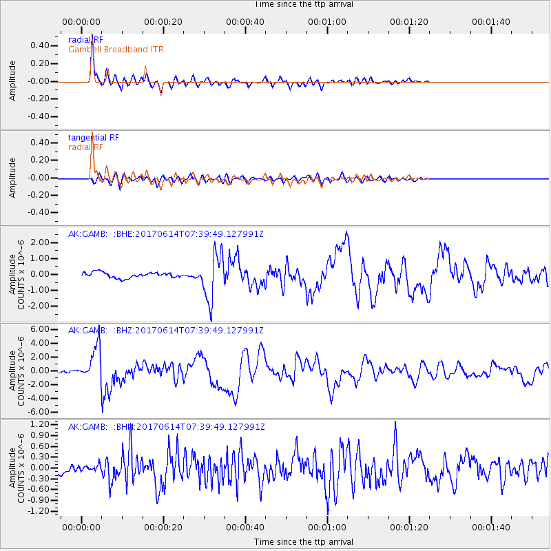
GAMB Gambell Broadband - Earthquake Result Viewer
*The percent match for this event was below the threshold and hence no stack was calculated.
| Earthquake location: |
Near Coast Of Chiapas, Mexico |
| Earthquake latitude/longitude: |
14.9/-92.0 |
| Earthquake time(UTC): |
2017/06/14 (165) 07:29:03 GMT |
| Earthquake Depth: |
98 km |
| Earthquake Magnitude: |
7.0 Mi |
| Earthquake Catalog/Contributor: |
NEIC PDE/at |
|
| Network: |
AK Alaska Regional Network |
| Station: |
GAMB Gambell Broadband |
| Lat/Lon: |
63.78 N/171.70 W |
| Elevation: |
10 m |
|
| Distance: |
72.2 deg |
| Az: |
332.672 deg |
| Baz: |
92.488 deg |
| Ray Param: |
$rayparam |
*The percent match for this event was below the threshold and hence was not used in the summary stack. |
|
| Radial Match: |
95.50832 % |
| Radial Bump: |
317 |
| Transverse Match: |
79.5669 % |
| Transverse Bump: |
400 |
| SOD ConfigId: |
13570011 |
| Insert Time: |
2019-04-28 05:01:27.722 +0000 |
| GWidth: |
2.5 |
| Max Bumps: |
400 |
| Tol: |
0.001 |
|
Signal To Noise
| Channel | StoN | STA | LTA |
| AK:GAMB: :BHZ:20170614T07:39:49.127991Z | 17.154867 | 2.6314067E-6 | 1.5339126E-7 |
| AK:GAMB: :BHN:20170614T07:39:49.127991Z | 0.60661614 | 7.845473E-8 | 1.2933177E-7 |
| AK:GAMB: :BHE:20170614T07:39:49.127991Z | 6.646569 | 1.152835E-6 | 1.7344814E-7 |
| Arrivals |
| Ps | |
| PpPs | |
| PsPs/PpSs | |


